Exploring Iceland (August 15th – September 1st, 2022)

Fire and water
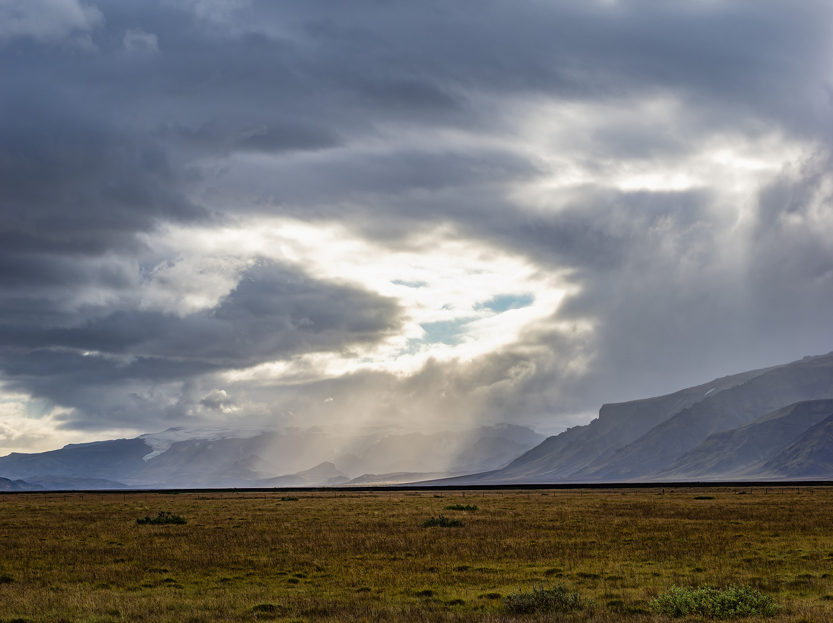
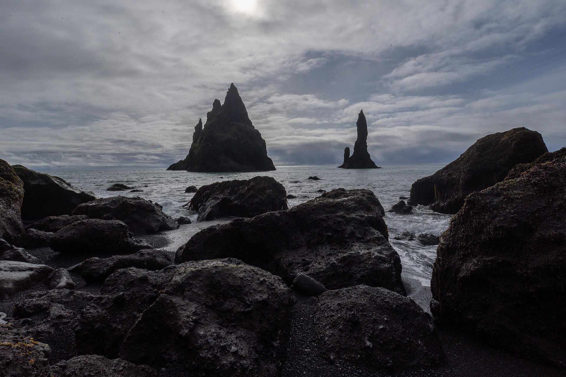
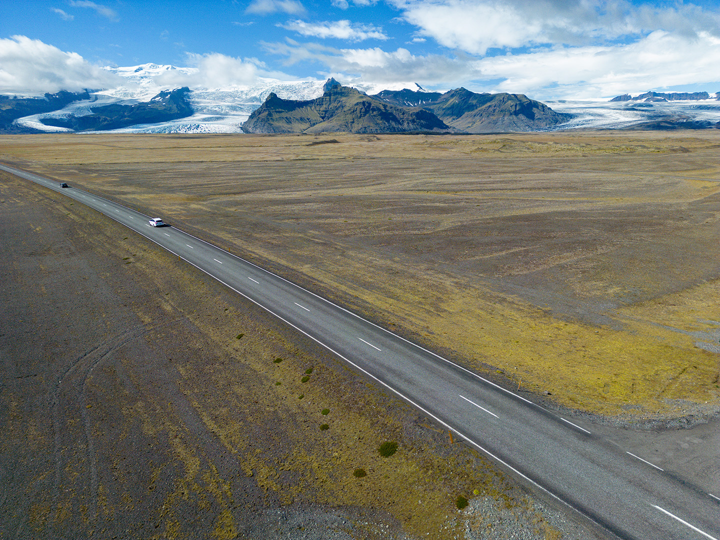
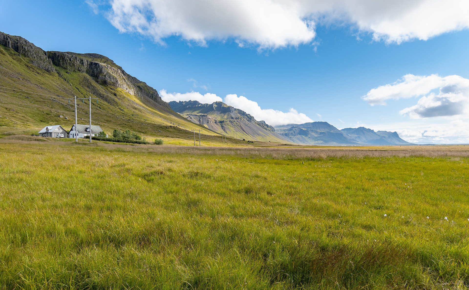
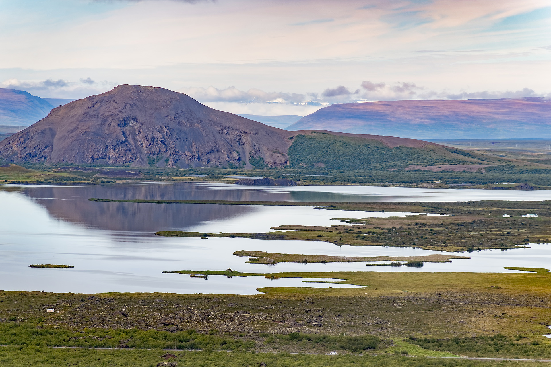
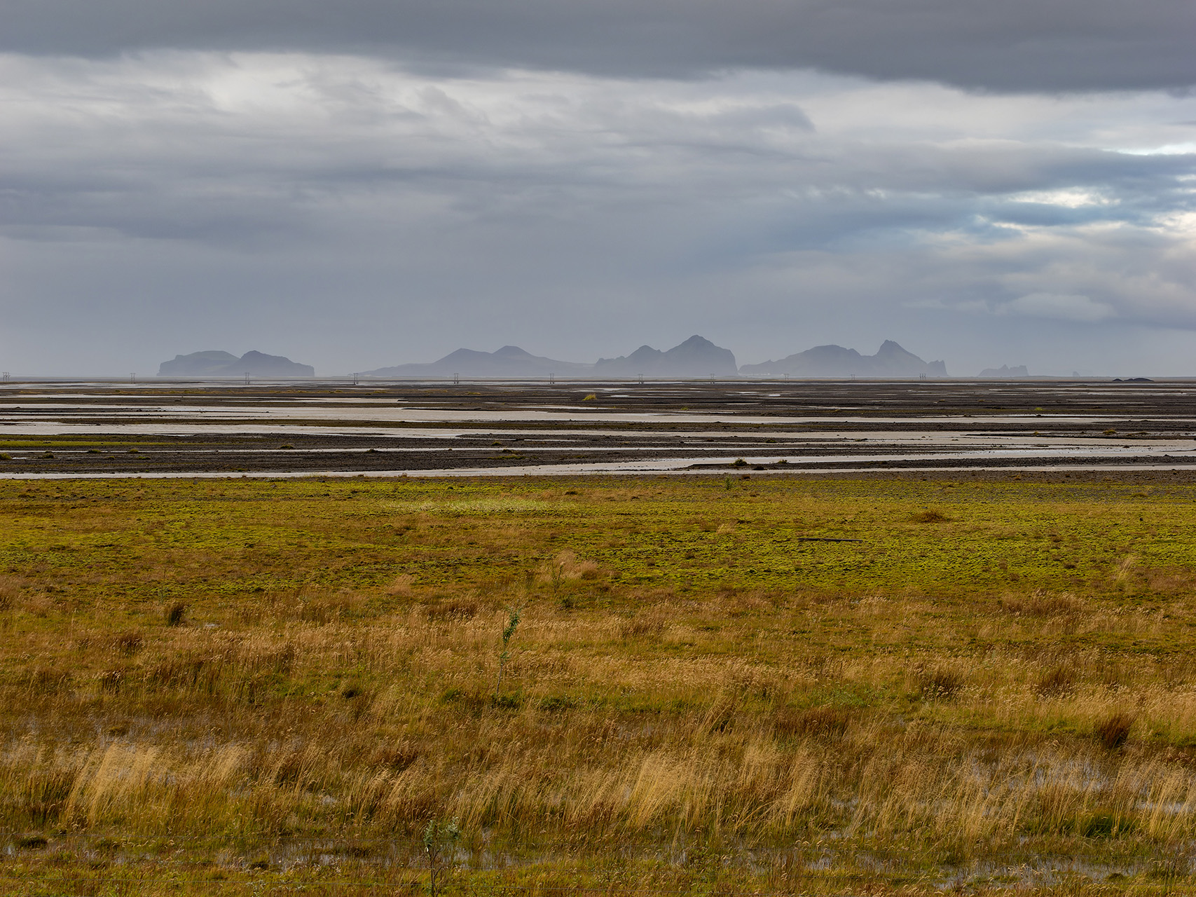
Volcanoes (can you say ‘Eyjafjallajökull’?) and rivers, lava fields and lakes, fiery eruptions and crystal clear waterfalls: these are images any mention of Iceland inevitably evokes in us. While there is a lot more to the island, these images themselves aren’t misleading. Iceland’s whole existence is rooted in fiery volcanoes that formed the landscape and still dominate it with solidified lava and volcanic ashes visible almost everywhere. While this island can be lush and green, its geologic history shows everywhere, as illustrated by this picture taken on an inland drive:


On the ‘fire’ front, things did not work out as we hoped they would. We had planned to do a 14-kilometer hike up to Fagradalsfjall and back, the volcano some 50 kilometers southwest of Reykjavik that started spitting lava in early August, less than two weeks before our arrival. However, we got stopped by the Iceland Police. Seriously. They blocked our access up the ramp leading to the parking lot where the hike began, saying it was too windy and rainy that day, and asking us to leave. Since we were scheduled to leave the whole area the following day, our adventurous career as volcano explorers was thus over before it even began. 😉
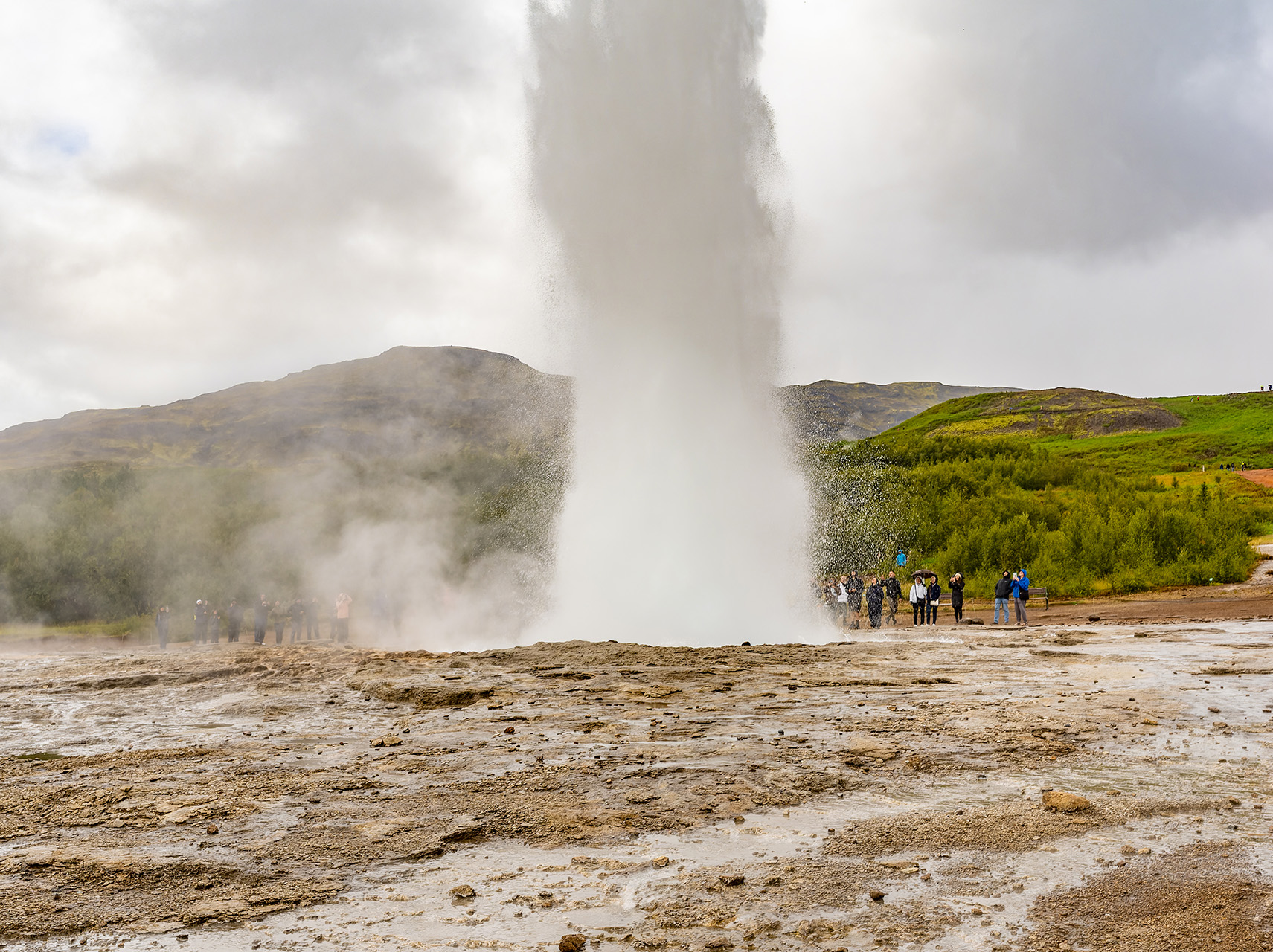
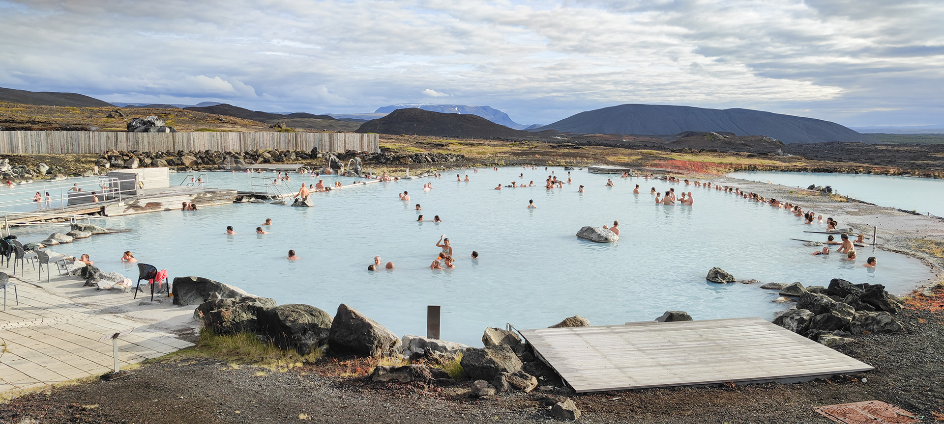
One thing is for sure: Iceland is a land of (natural) water. Water is found almost everywhere on this island, even when ignoring the frequent rain. Natural water is ubiquitous here. To illustrate the point: in the bathroom of our hotel, located right in the center of Reykjavik, a sign explained that not only the cold water came from a natural spring and was perfectly drinkable, but the hot water also stemmed from a natural source and therefore contained sulfur. Which was easy to smell anyway.
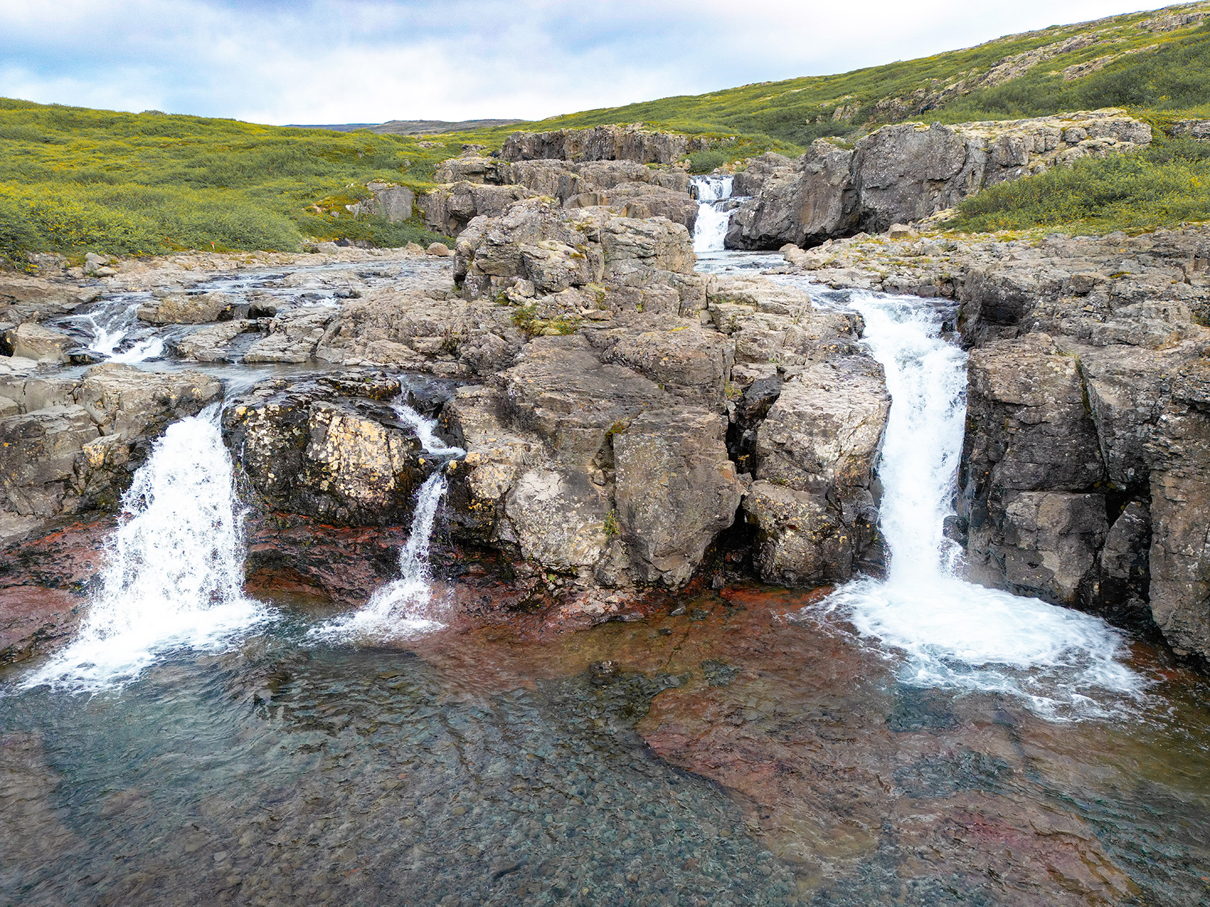
We couldn’t even begin to count how many rivers and waterfalls we came across. Here is but a small selection to at least give you an impression:
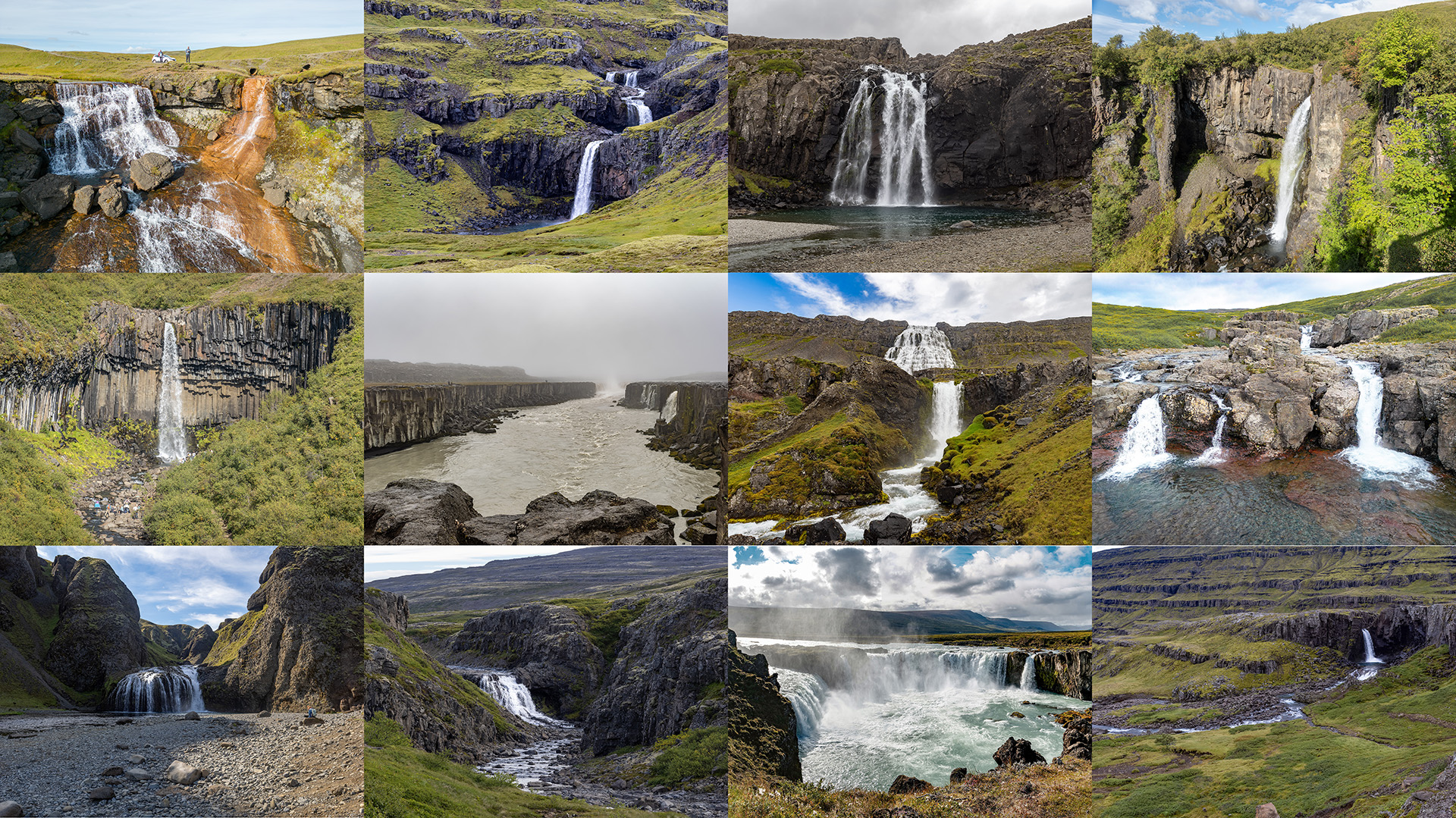
Each and every one of them was beautiful in its own right. Picking out a few, I’ll start with mighty Dettifoss, Iceland’s largest in terms of throughput. Its water flow equals that of the Rhine Fall in Schaffhausen, Switzerland. Are you able to tell how the weather was when we went there?


Gullfoss, “Golden Waterfall” in English, is Iceland’s most popular waterfall, owing to its size and layout, as well as its proximity to the capital and other Iceland highlights.
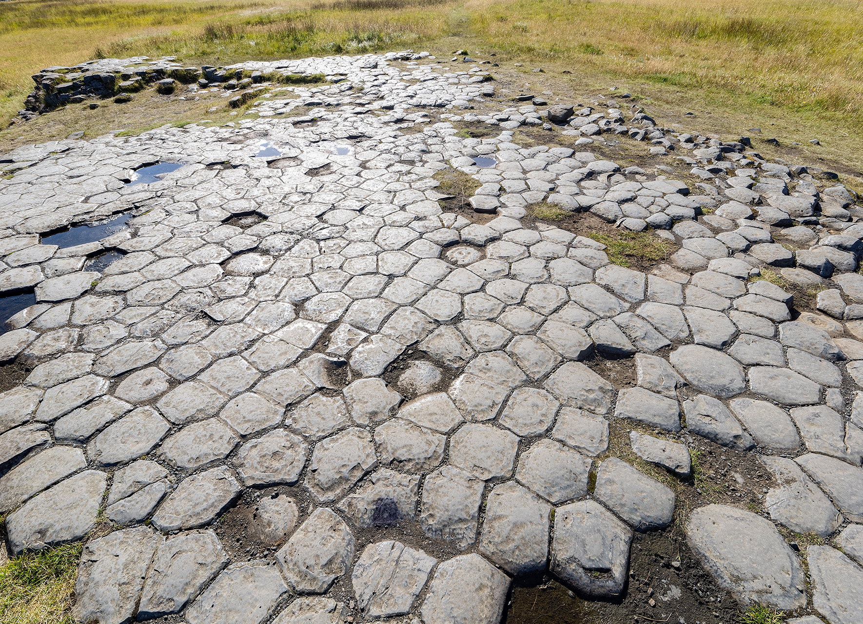
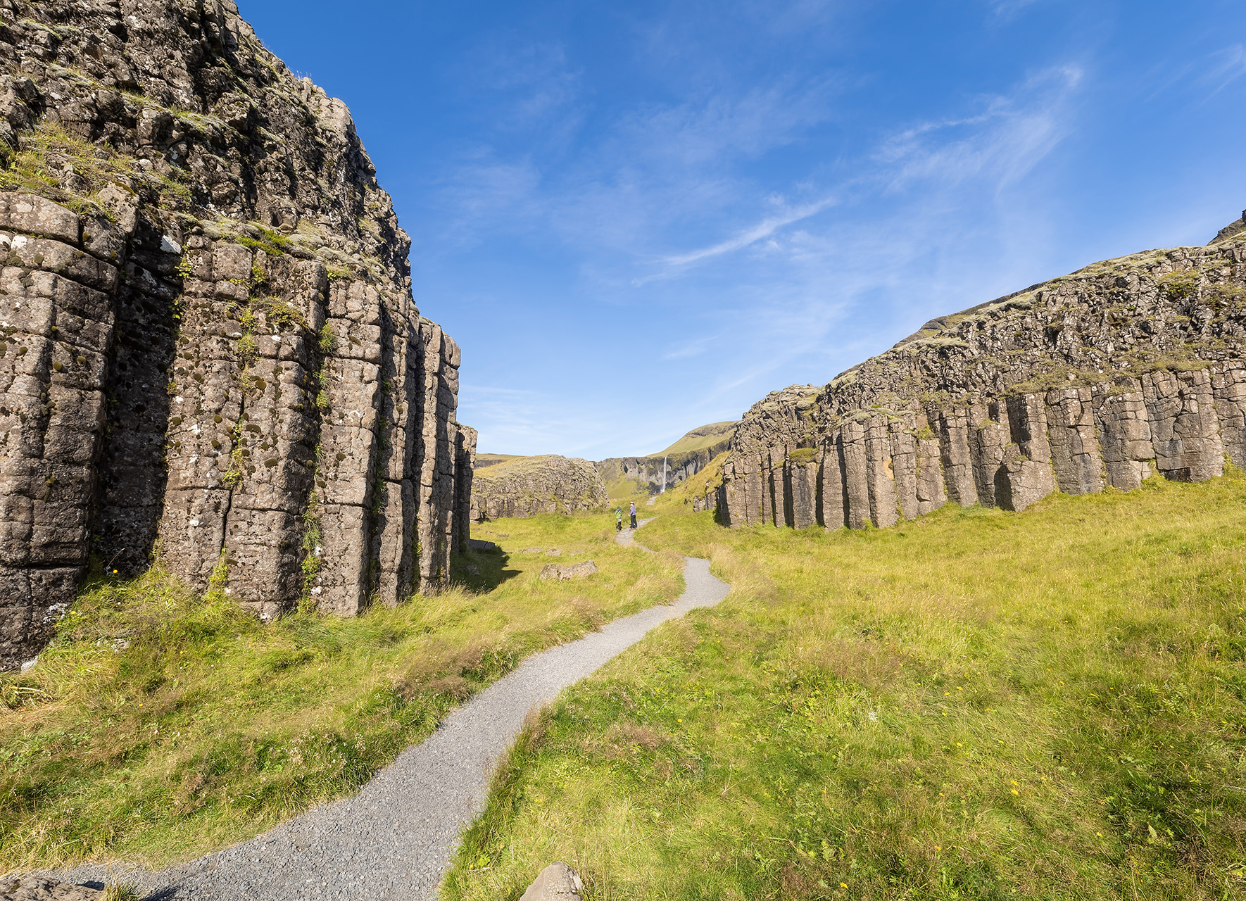
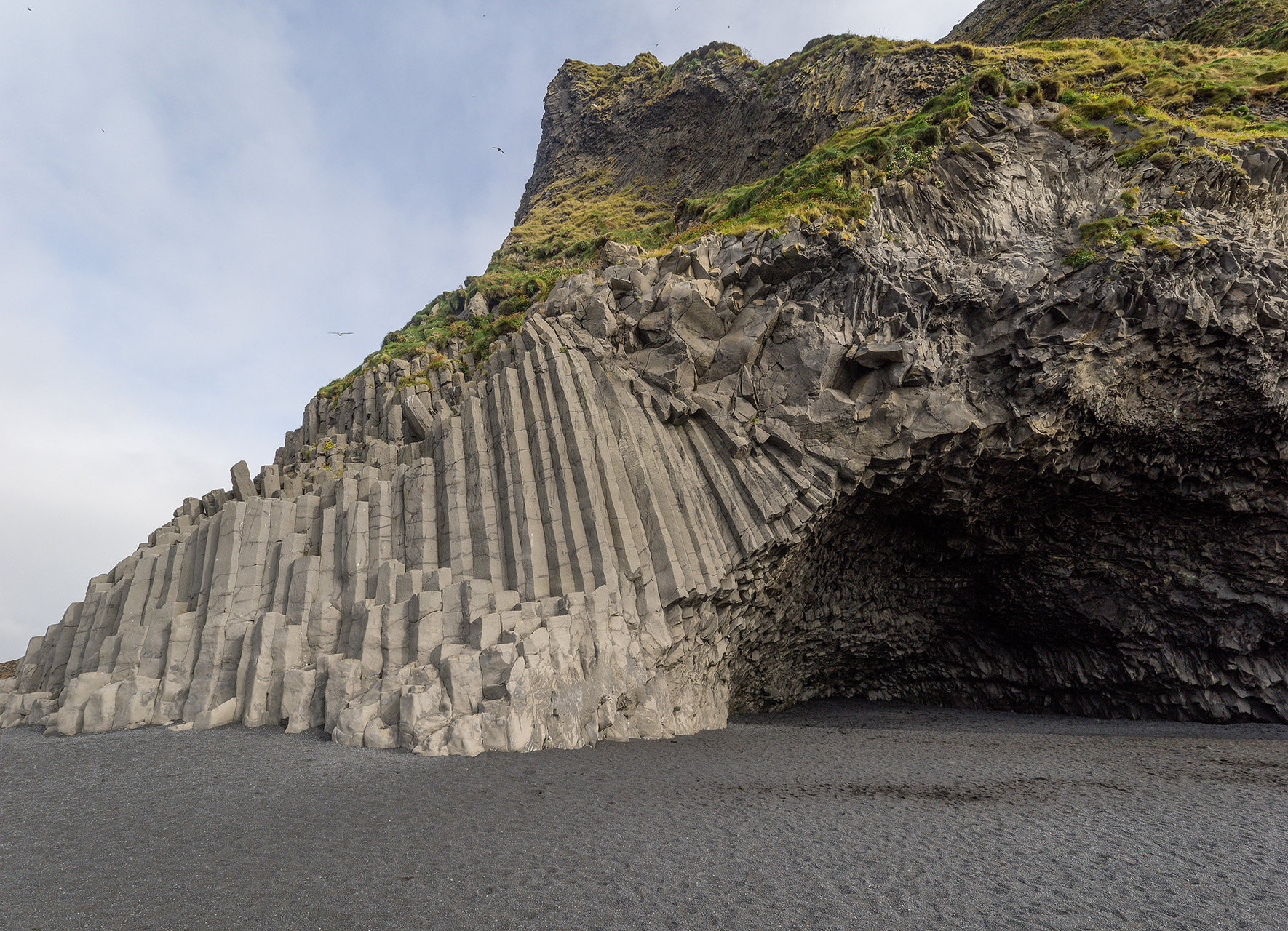
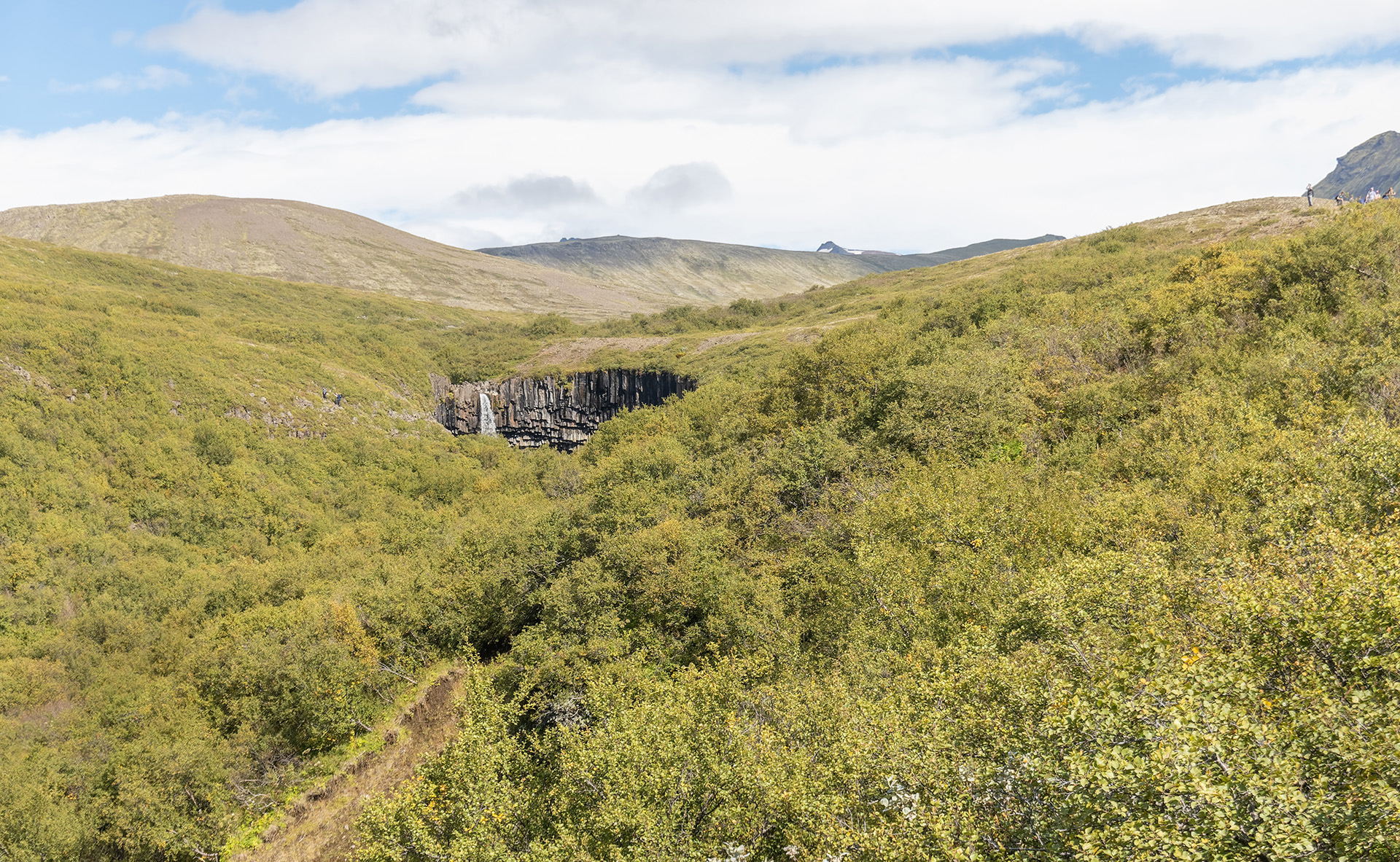
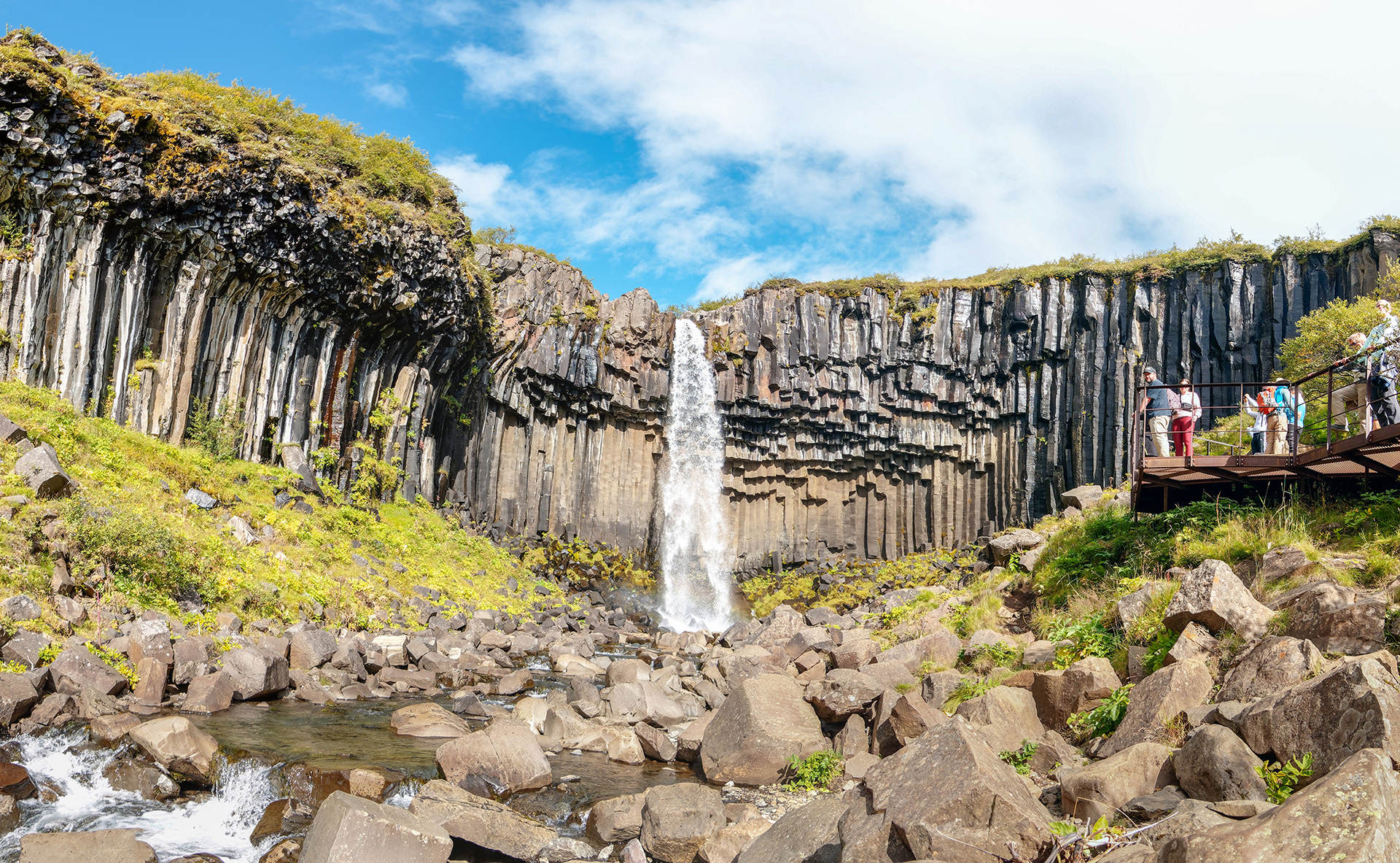
Svartifoss, another one of Iceland’s celebrities, may be best suited to illustrate “fire and water”: with the basalt columns that surround it, it is as picturesque as it is intimidating.
My last waterfall picture here shows one of the less prominent ones that are found all over the country. This drone shot of Thingmannaåfoss, in the Westfjords, brings out some of the beauty of what is actually a much larger cascade of individual waterfalls and gorges.
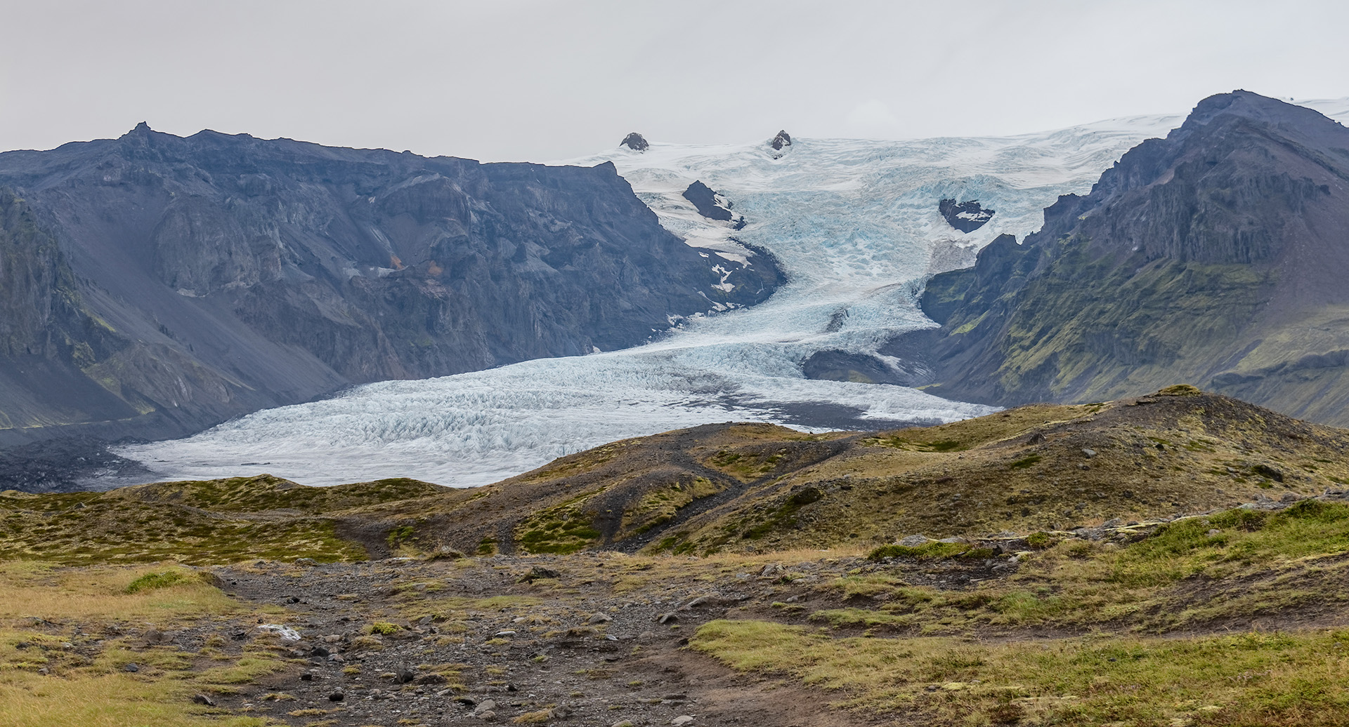
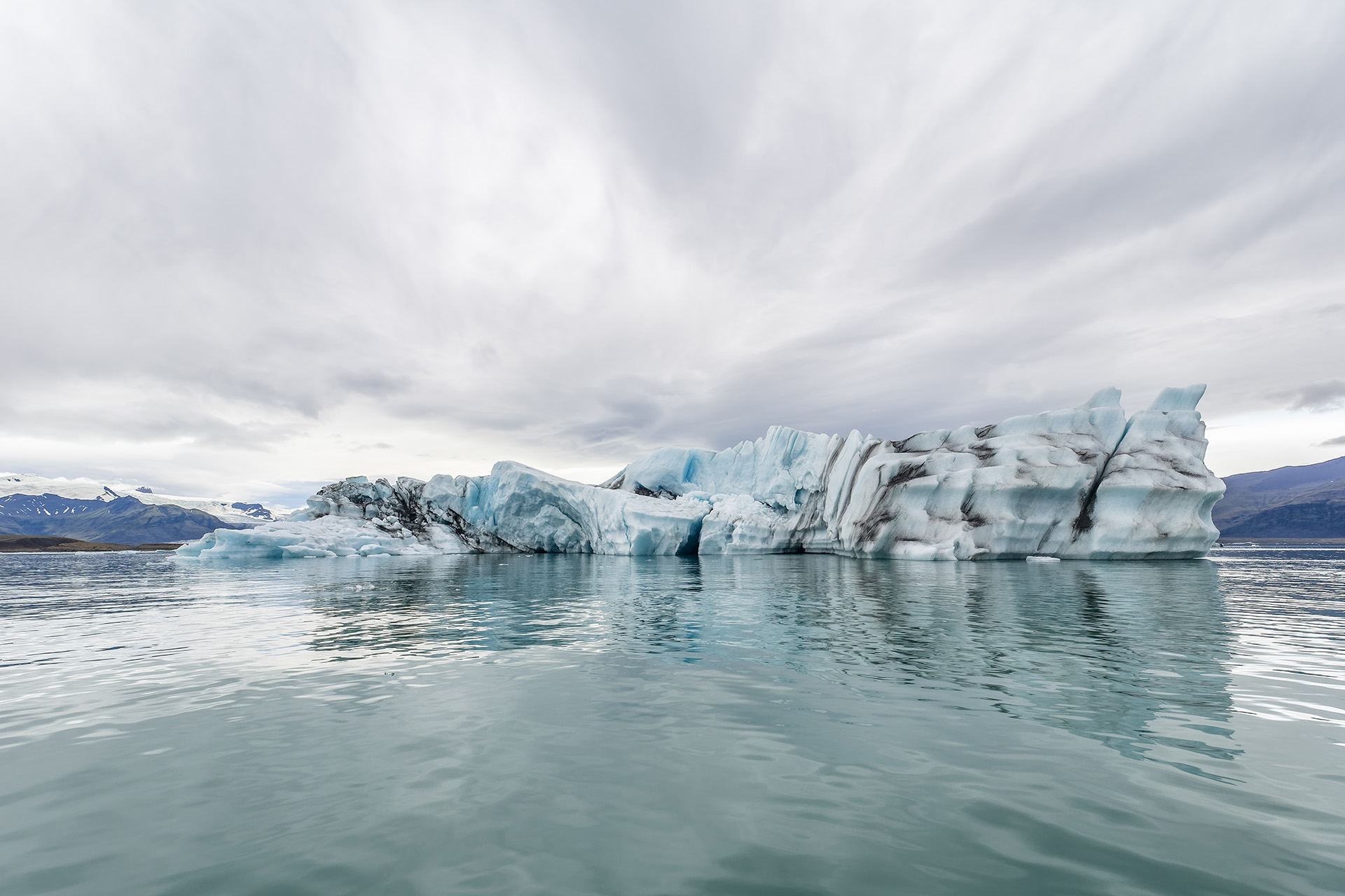
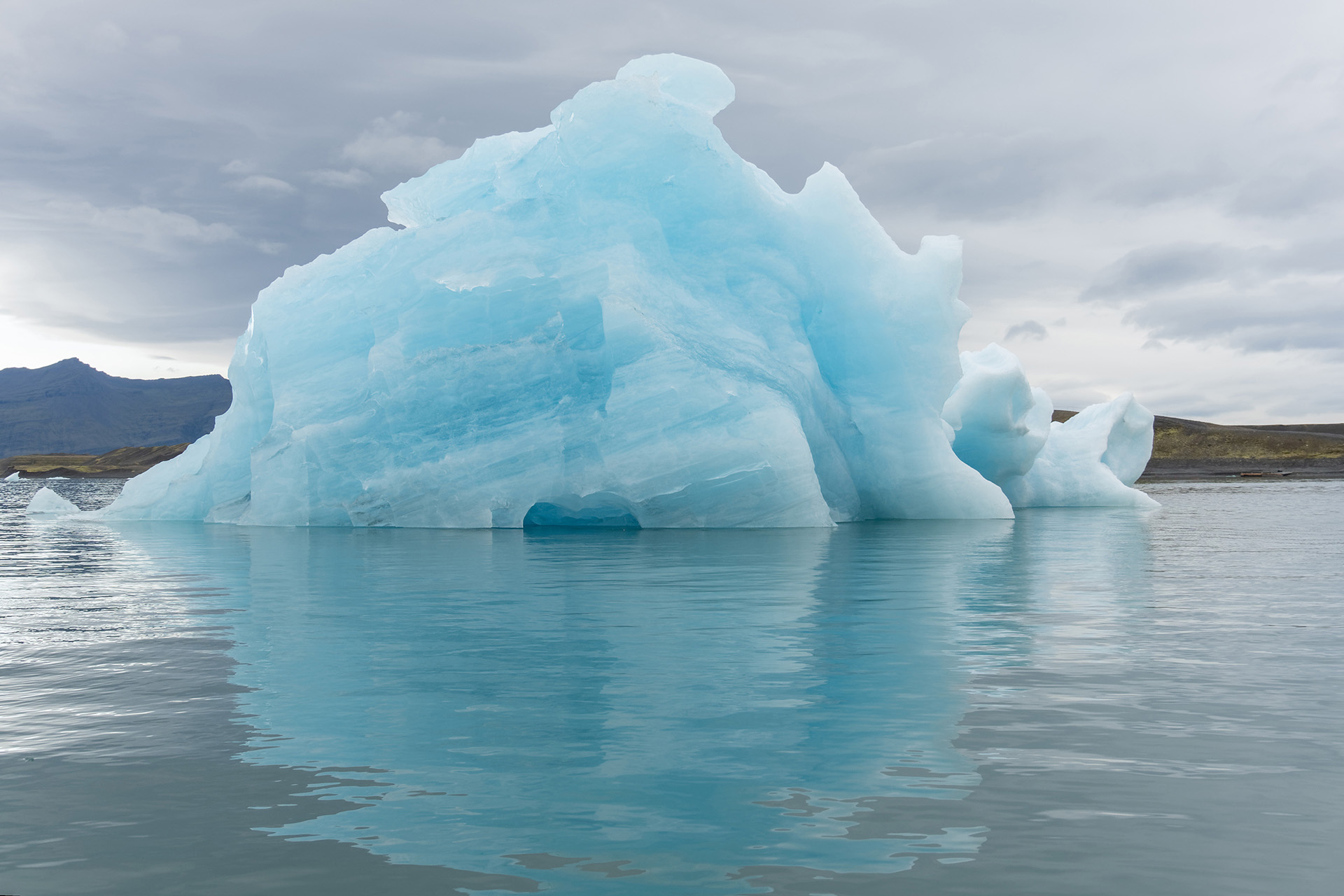
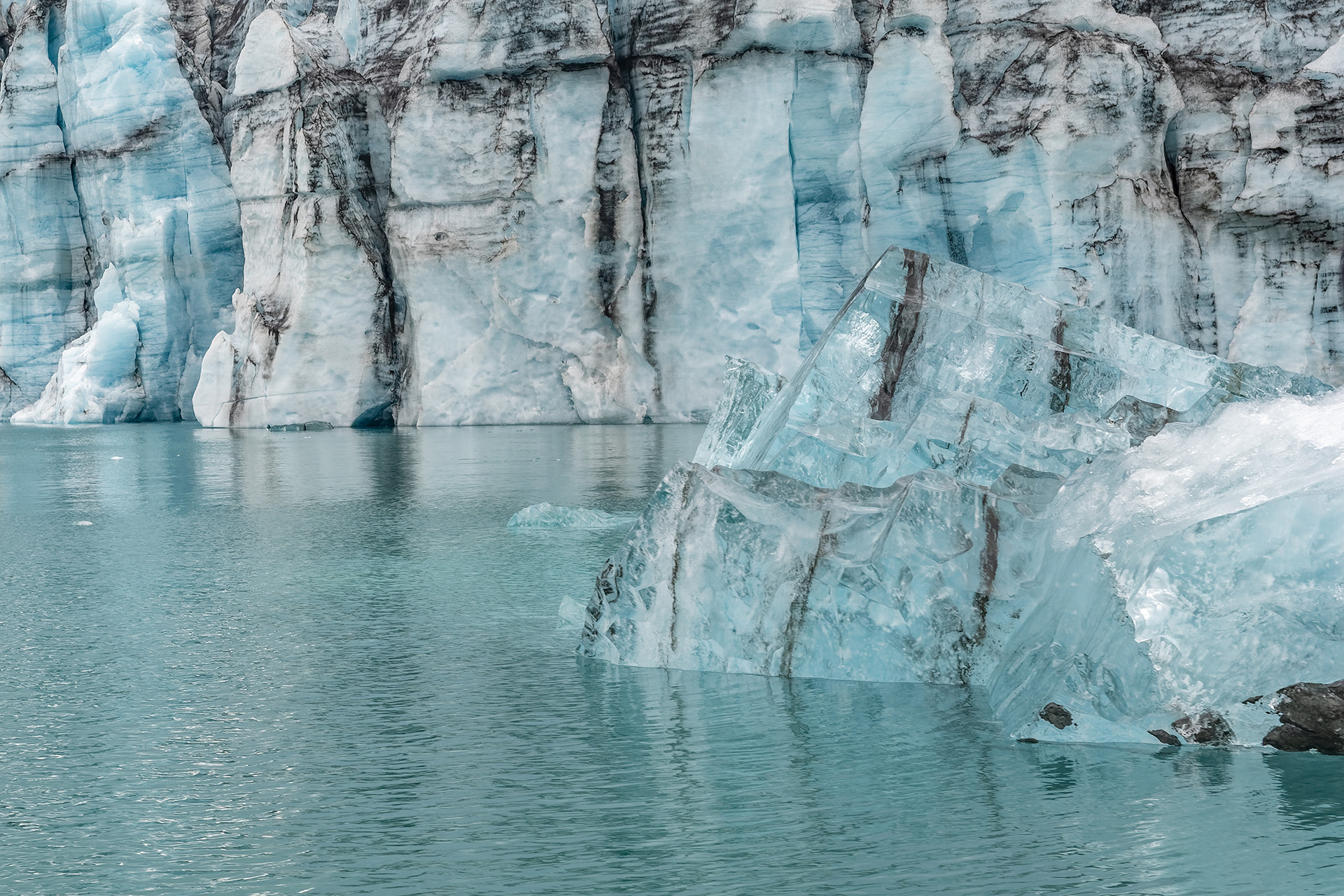
Feeding all these lakes, rivers and waterfalls are Iceland’s glaciers. In spite of its unpronounceable name, Eyjafjallajökull is currently the most prominent of them, owing to its 2010 ash eruption that blocked air traffic between Europe and North America for several days. However, it pales in comparison to Vatnajökull, the largest by far of Iceland’s glaciers that features a total of 38 individual glacier tongues, each with its own name. Here are pictures of just a few of them:

The trip
‘Windy’ and ‘rainy’ are terms that characterize much of our stay in Iceland rather well. J The locals told us the summer was unusually cold. We soon realized why, as 13 degrees Celsius, about 56 Fahrenheit, already felt like a heat wave, with daytime highs often not making it into the double digits (50 Fahrenheit or more). Remember: that was in August. While we got enough sunny days to make up for at least some of that, we also often endured heavy rains, occasionally combined with dense fog that made driving a nuisance.
Like everyone flying to Iceland, we started out at the Kevlavik airport, on the outskirts of Reykjavik, an area where more than 200,000 people and thus more than 50 percent of all Icelanders live. (To put things in perspective: Iceland’s largest city that is NOT in the Reykjavik metropolitan area, Akureyri, has less than 20,000 inhabitants.)
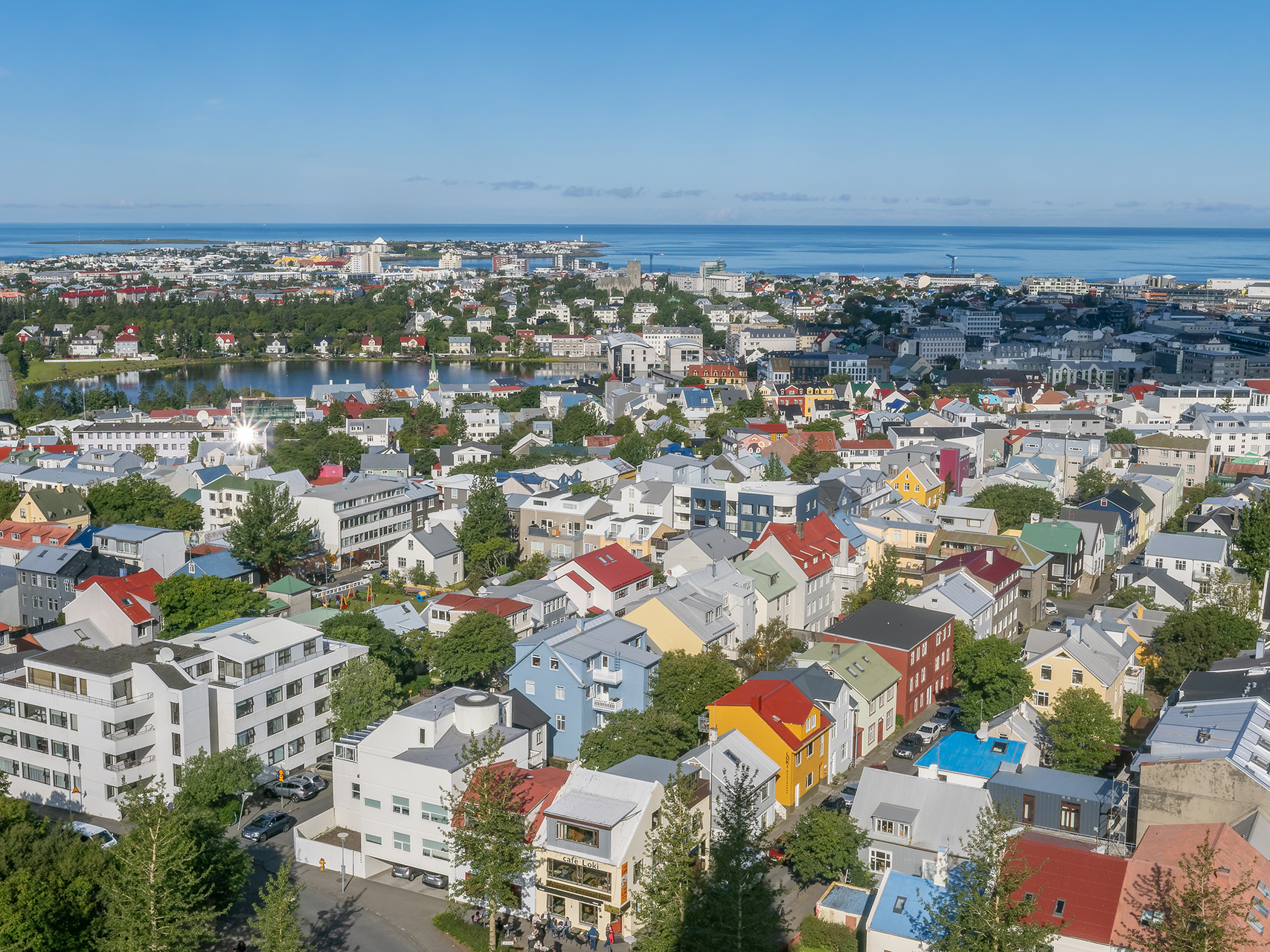
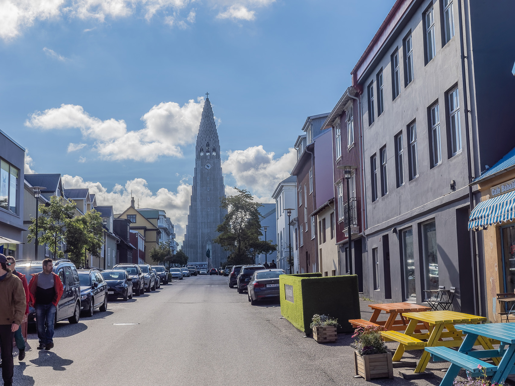
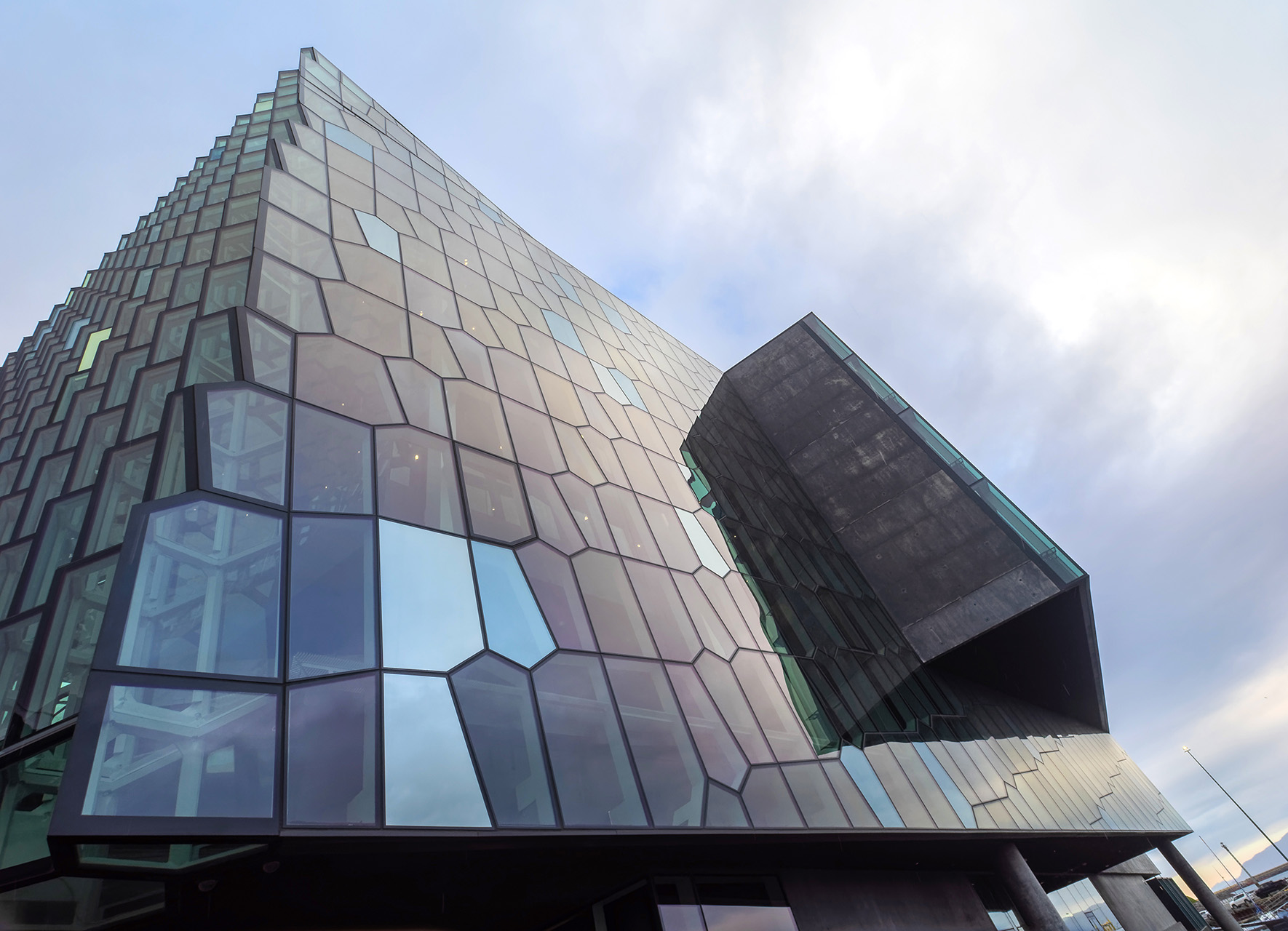

Reykjavik is a large and fairly lively city, but by the third day at the latest, you’ll be looking to move on. And so we did.

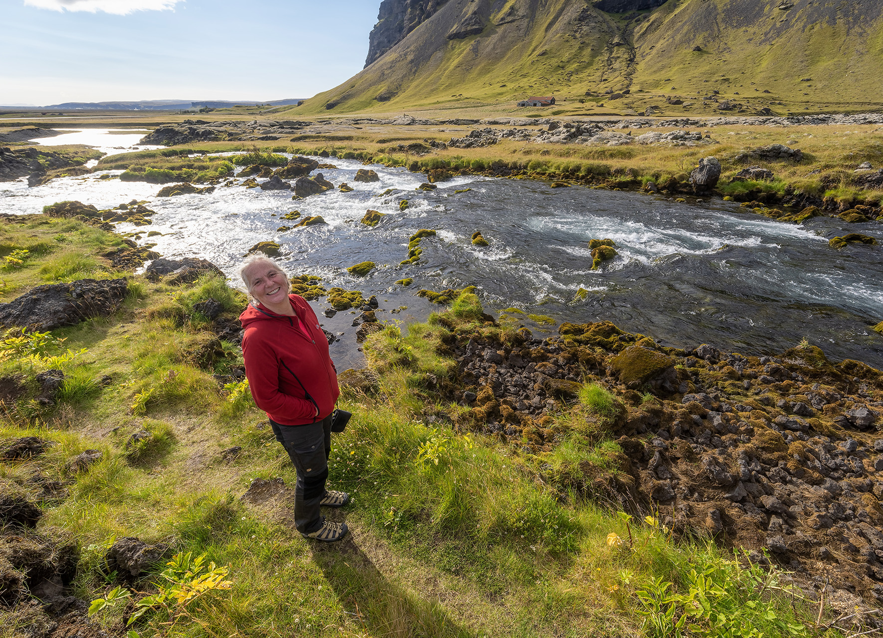
Again like everyone else, we mostly followed the ring road, going around the island in clockwise direction. All in all, we drove well in excess of 2,000 km in our wannabe 4×4 (it wasn’t one, but it at least looked the part and served us well enough). The map also illustrates how much of this country is almost inaccessible: there are a few routes crossing its vast interior, but those require large 4x4s with extreme ground clearance and are even then difficult and sometimes impossible to navigate. Even parts of the ring route get blocked off in inclement weather, which then seals off some areas completely.
The land
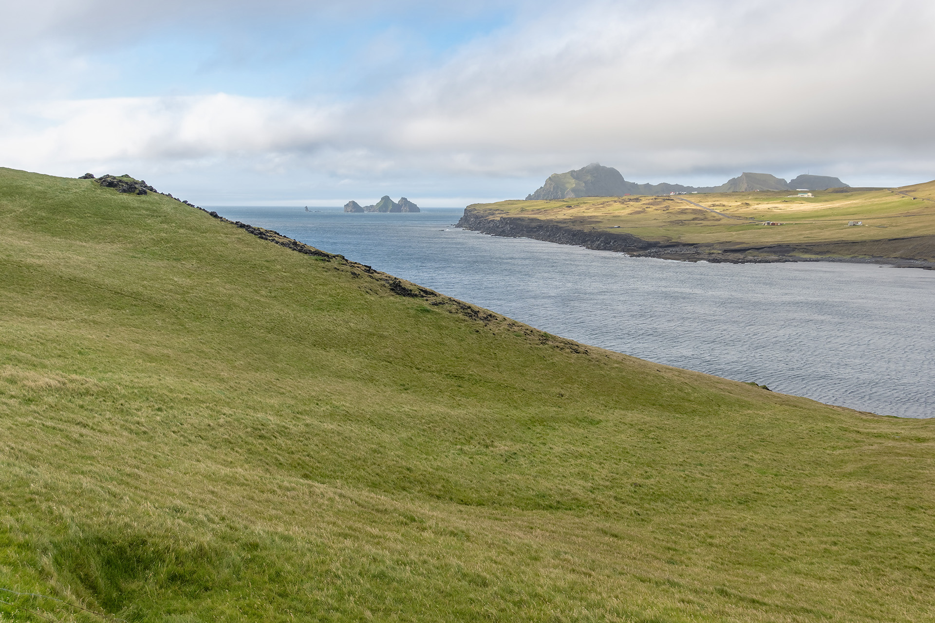
If asked about highlights of our trip, I’m tempted to say that the trip itself was the highlight. Iceland is beautiful almost everywhere you go, each area in its own ways. Listing some here inevitably does injustice to others, and there is much we haven’t seen anyway.
The Snæfellsness peninsula is said to present a “miniature copy of Iceland”, as it’s got everything that is typical of the country. Since we lacked the time to drive around it all the way, we only saw Snæfellsjökull, the large glacier near its tip, from afar, but it did not take that to convince is that the term is appropriate.


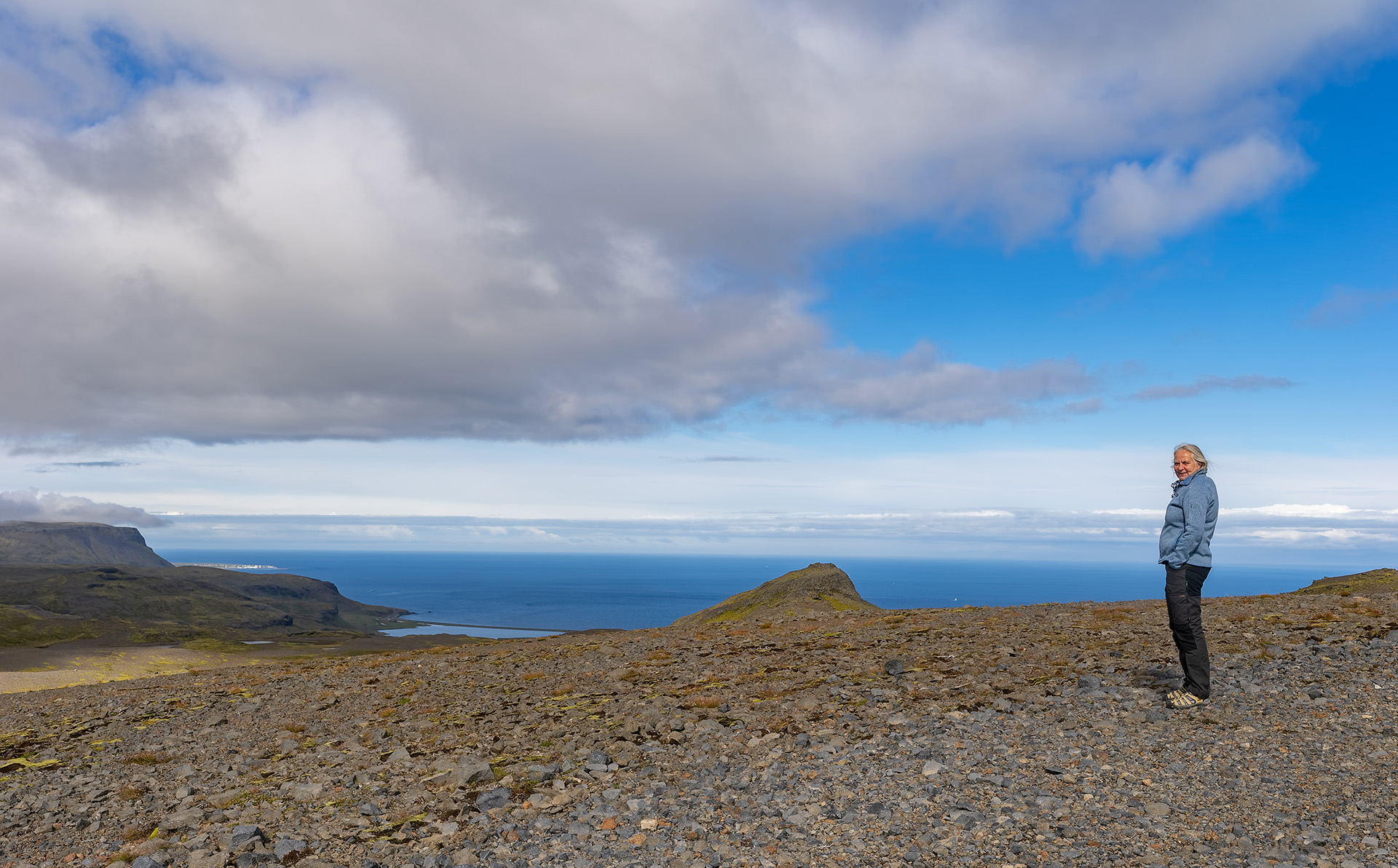
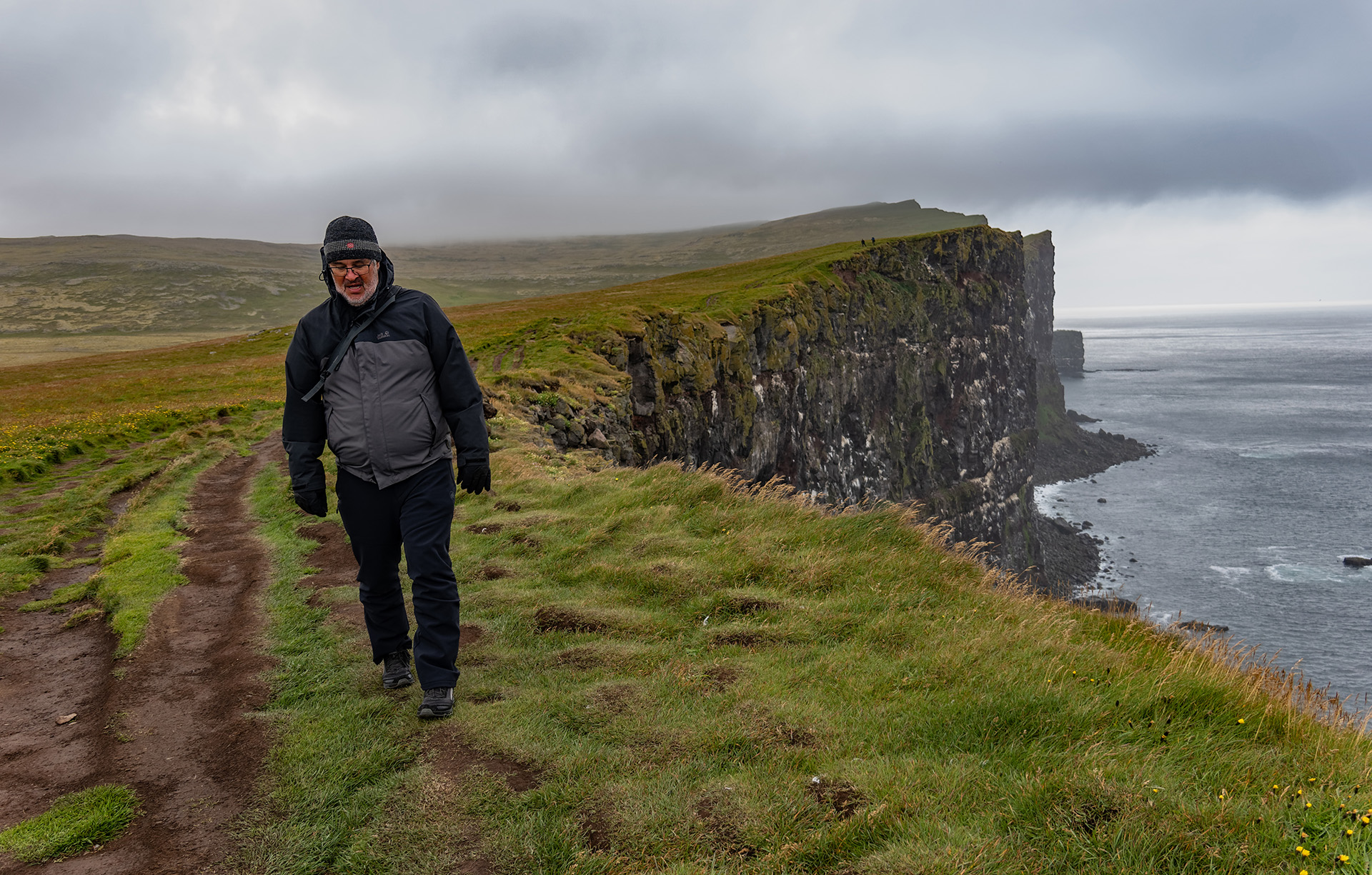
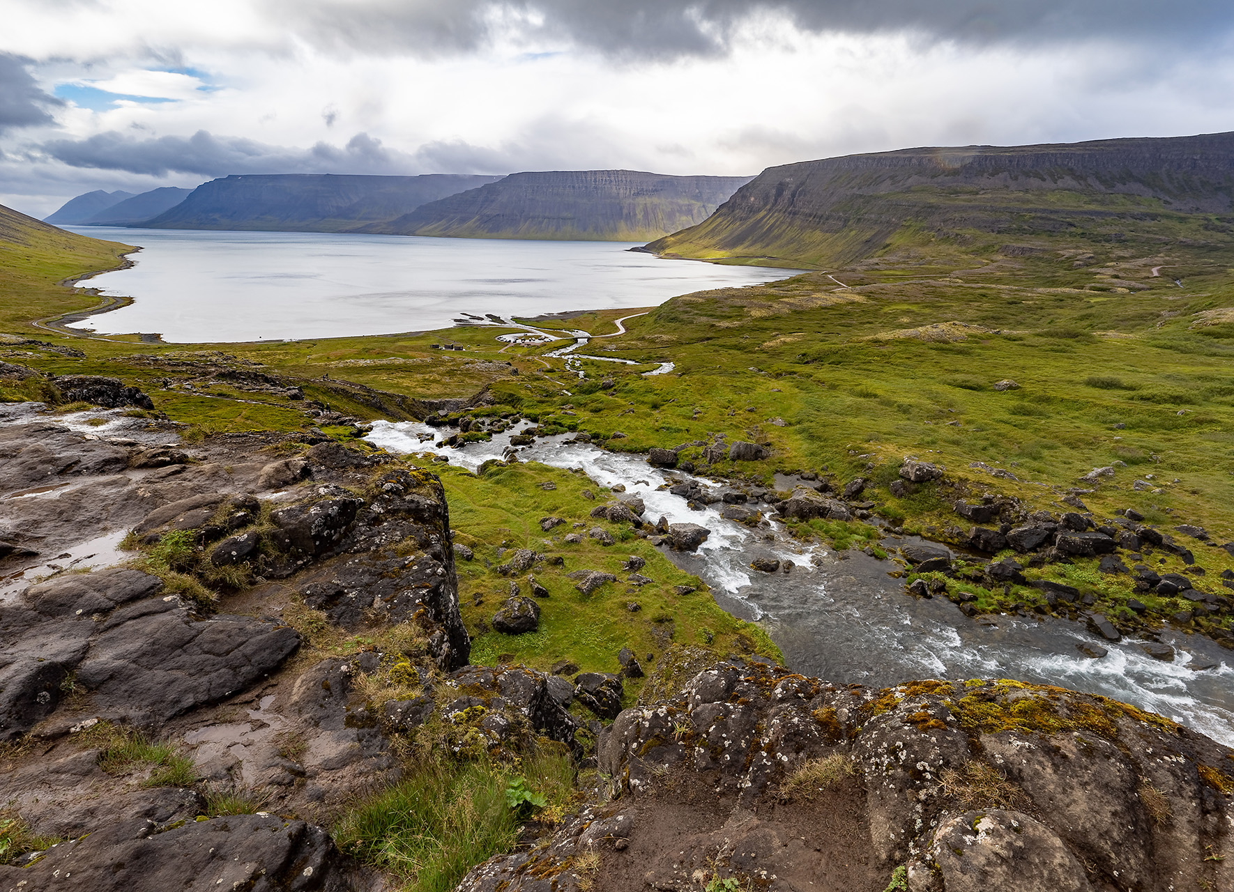
Our visit to the Westfjords coincided with mostly terrible weather, especially when we drove out to Latrabjerg, a 14-kilometer cliff marking Iceland’s western end. Mist and fog unfortunately kept us from seeing much, which was a pity.

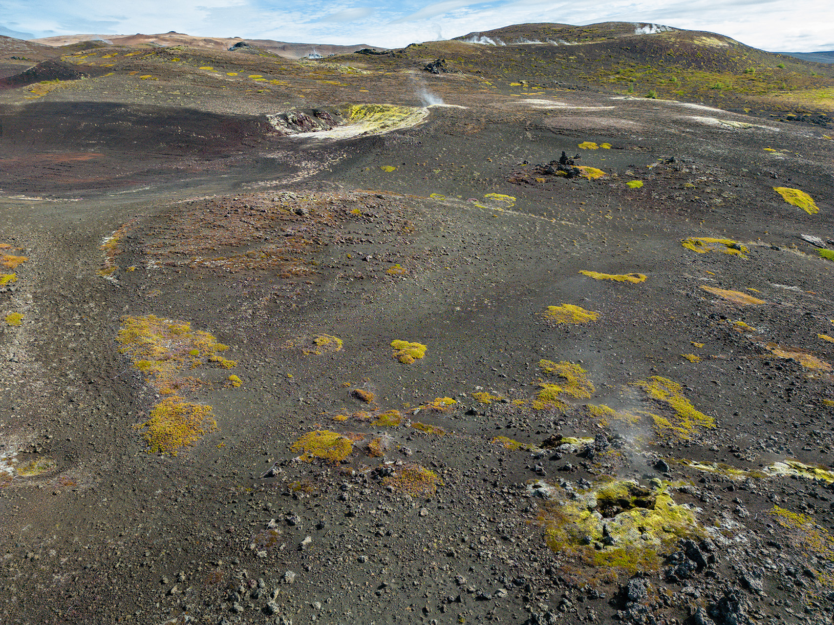
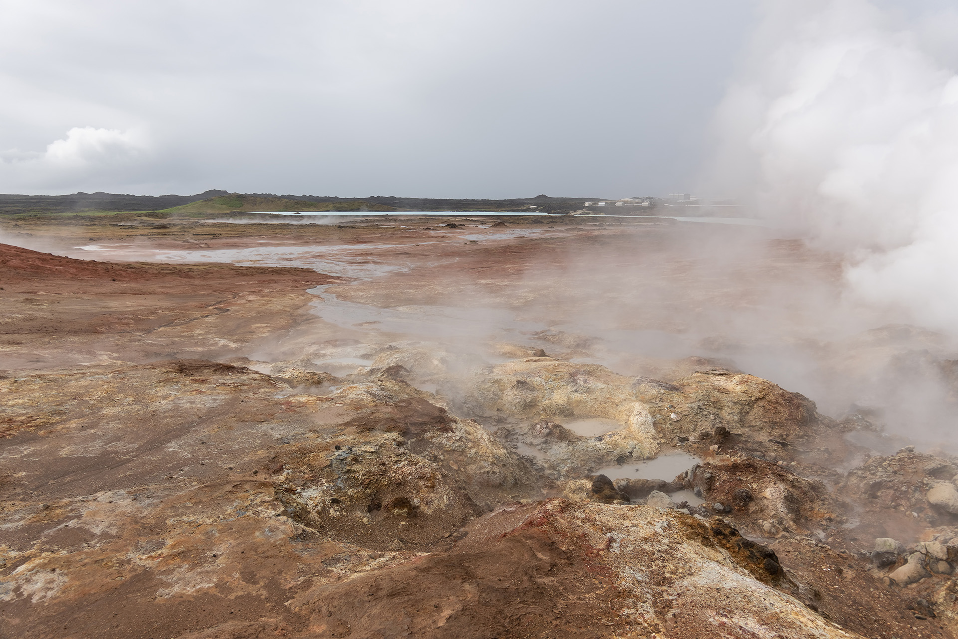
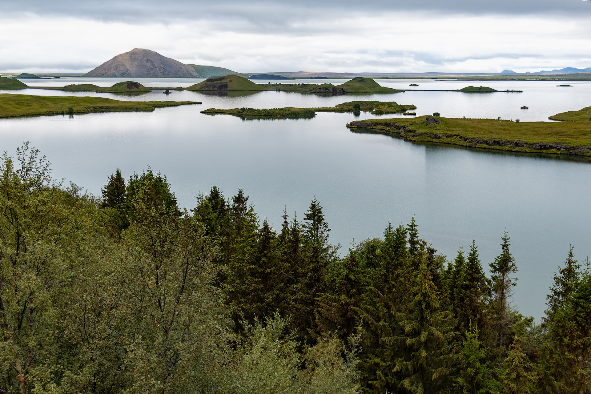
Myvatn translates to “Mosquito Lake”. Well, not with this kind of weather – there weren’t any. 😉 What it had to offer instead were gorgeous landscapes and fascinating volcanic activity.


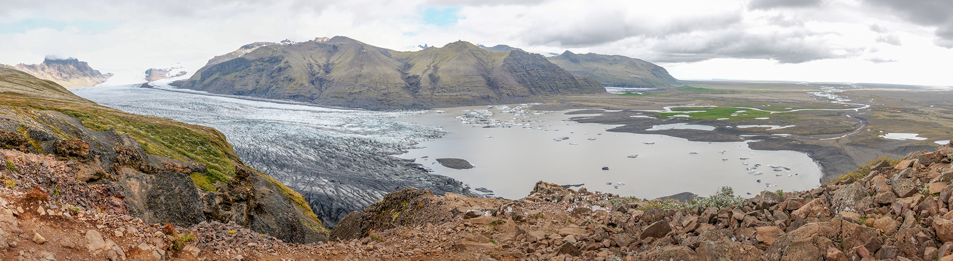
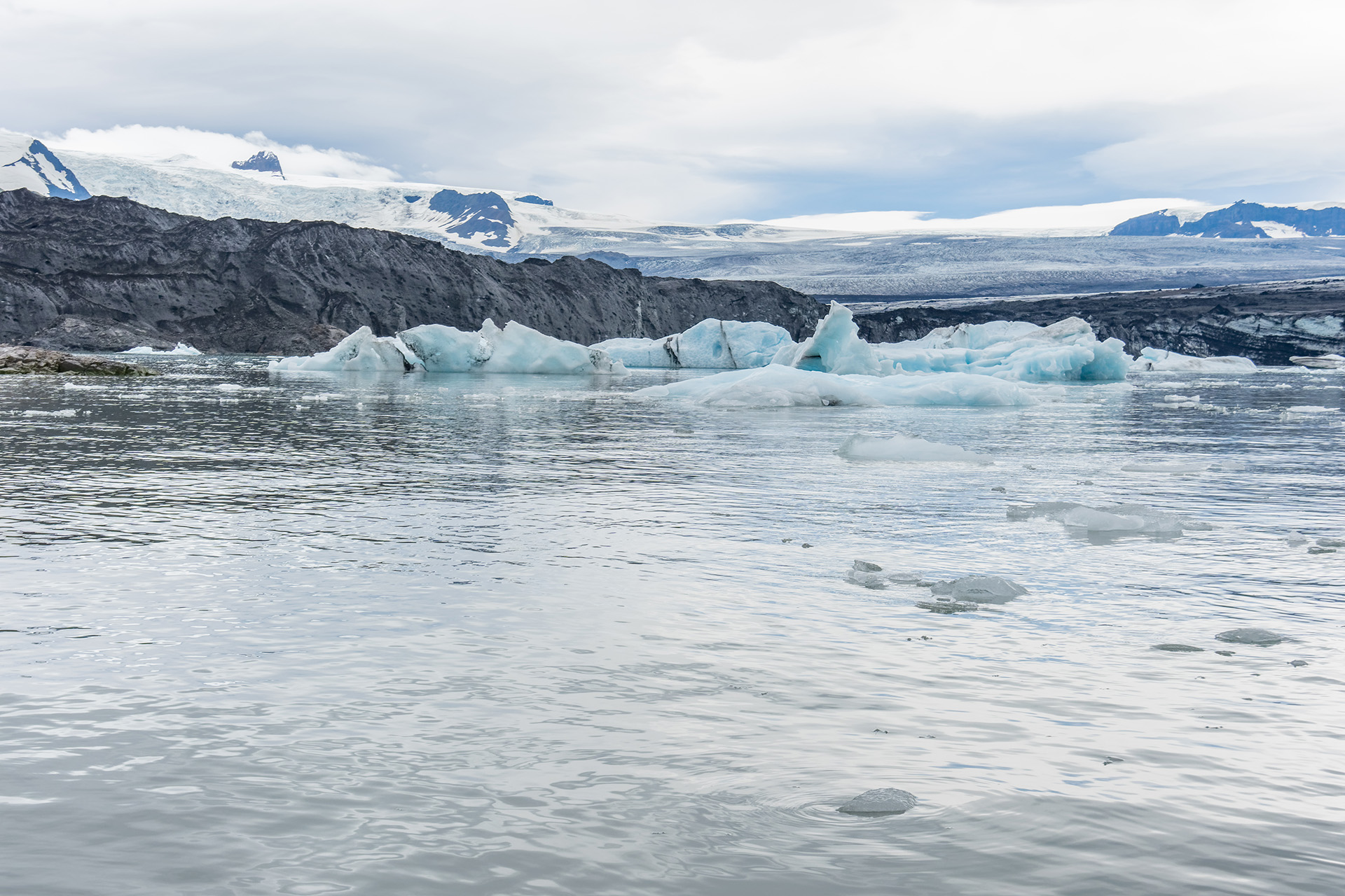
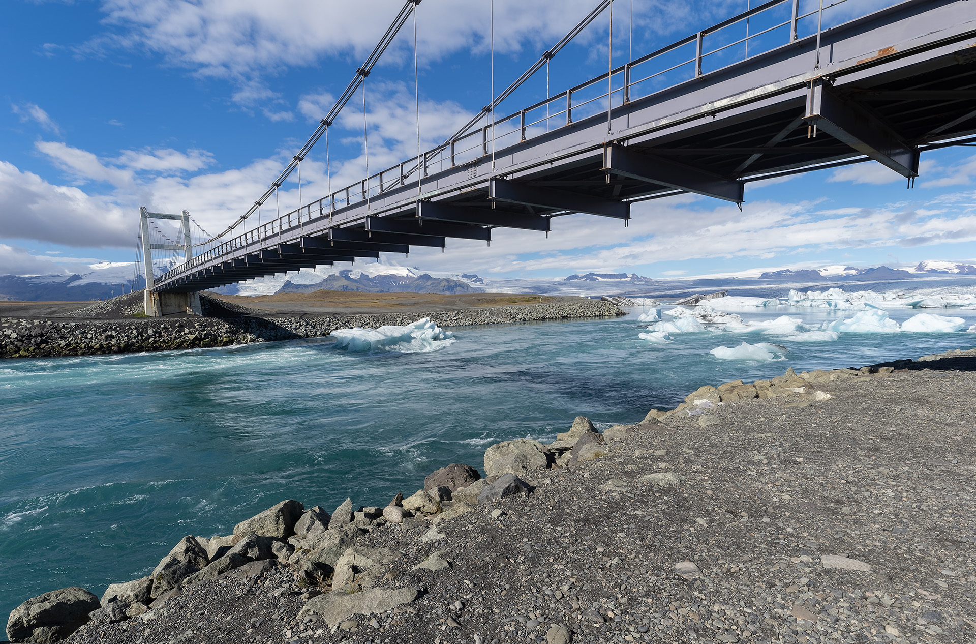
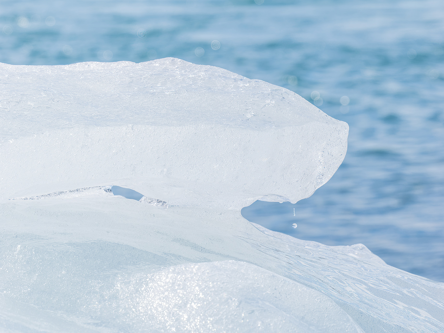
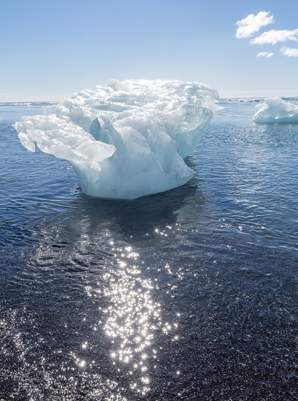
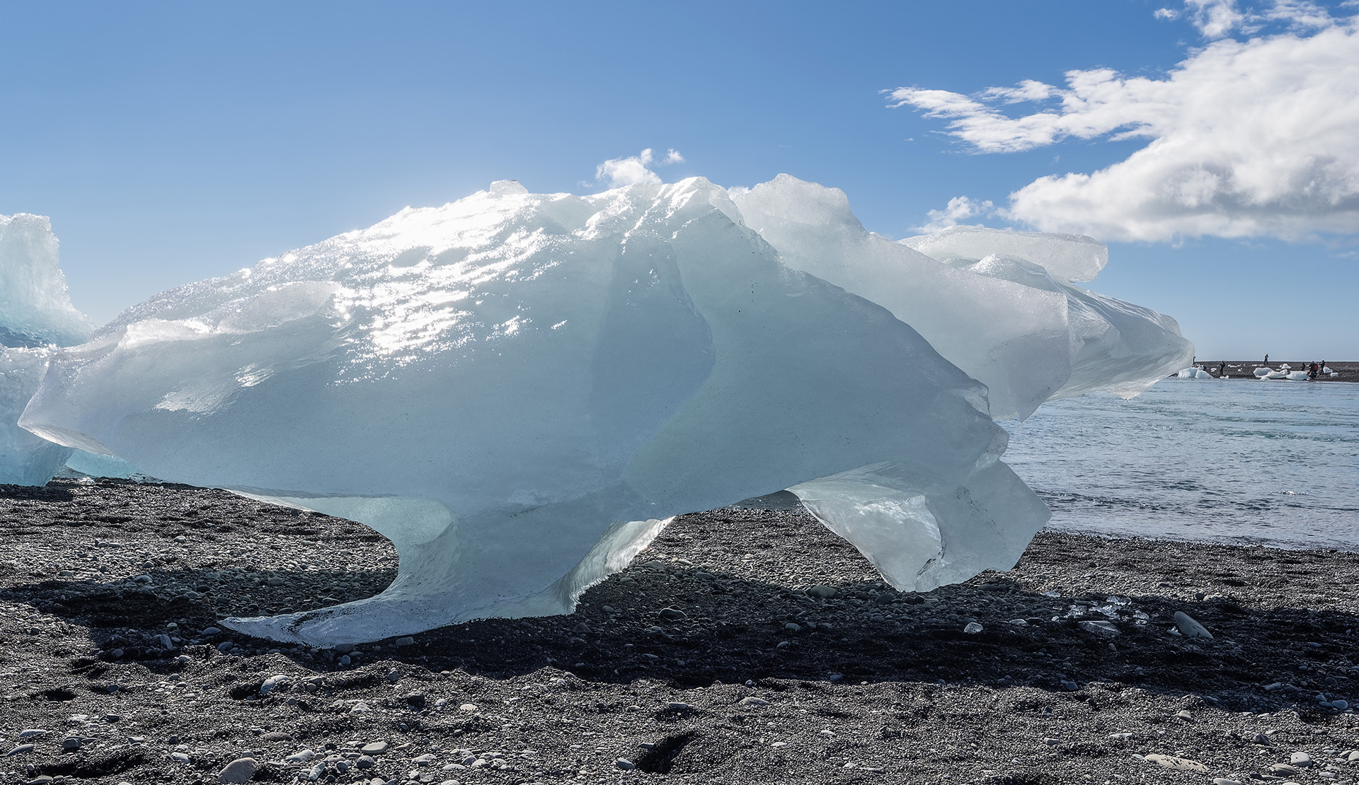
Next, we went to Jokulsarlon, a glacier lake that is connected to the sea via a short channel. Our first stop there had us on a pre-booked zodiac tour for an hour. We were in luck, as that very hour was the only one without rain during the whole day. Returning the following day, I found the weather to be much more cooperative and got some beautiful shots. Smaller and larger pieces of ice continually break off Sveitarsjökull, the glacier tongue of Vatnajökull that feeds the lake. They make their way across the lake and into the ocean, only to end up getting washed ashore at the small beach zone separating lake and sea, the one they call “Diamond Beach”. It is easy to see why: as the pieces of ice gradually melt, they become clearer and also a more intense blue. They resemble diamonds as they near their end.


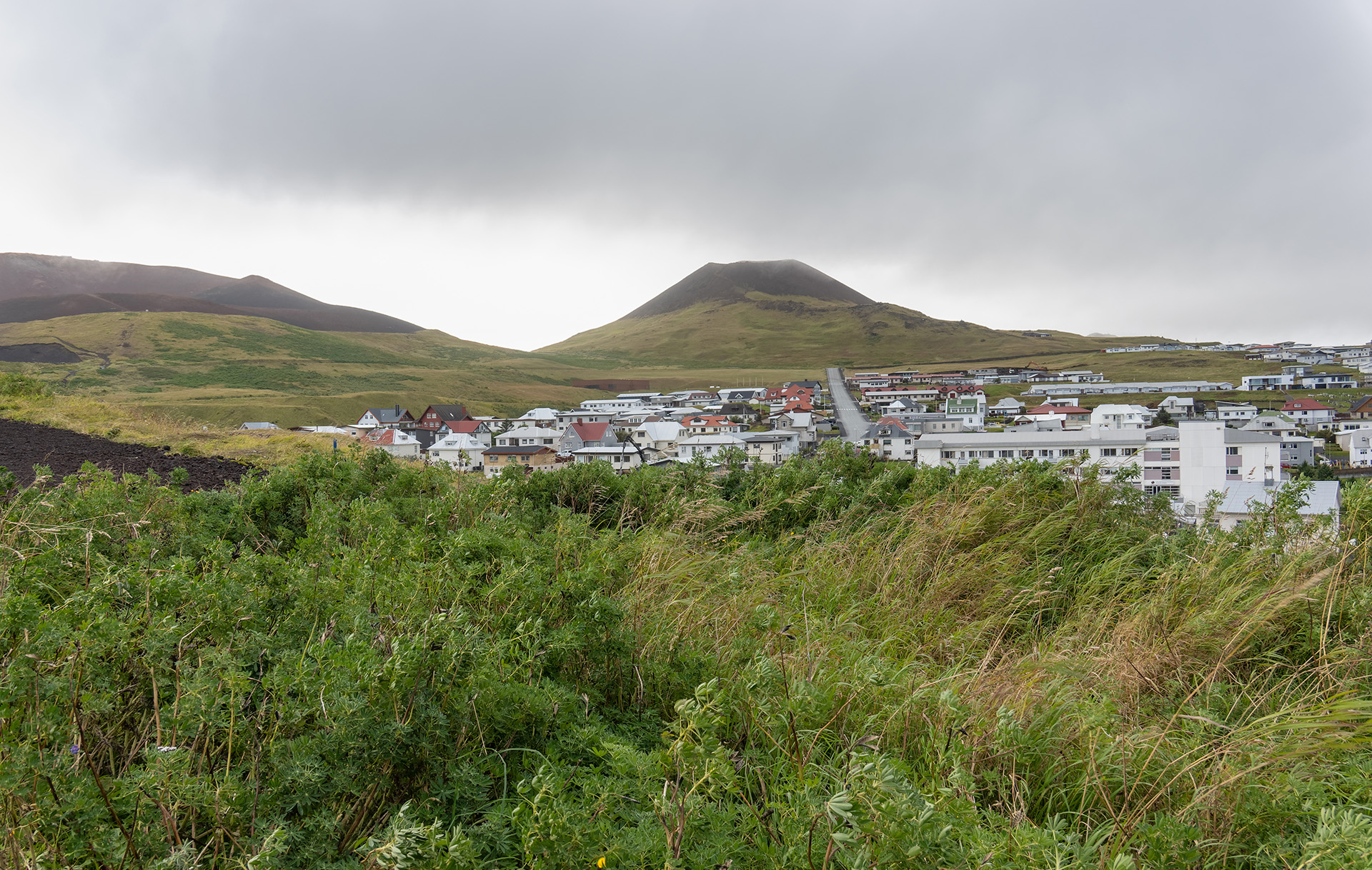
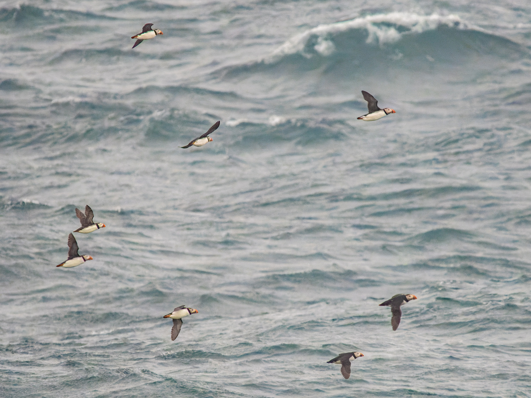
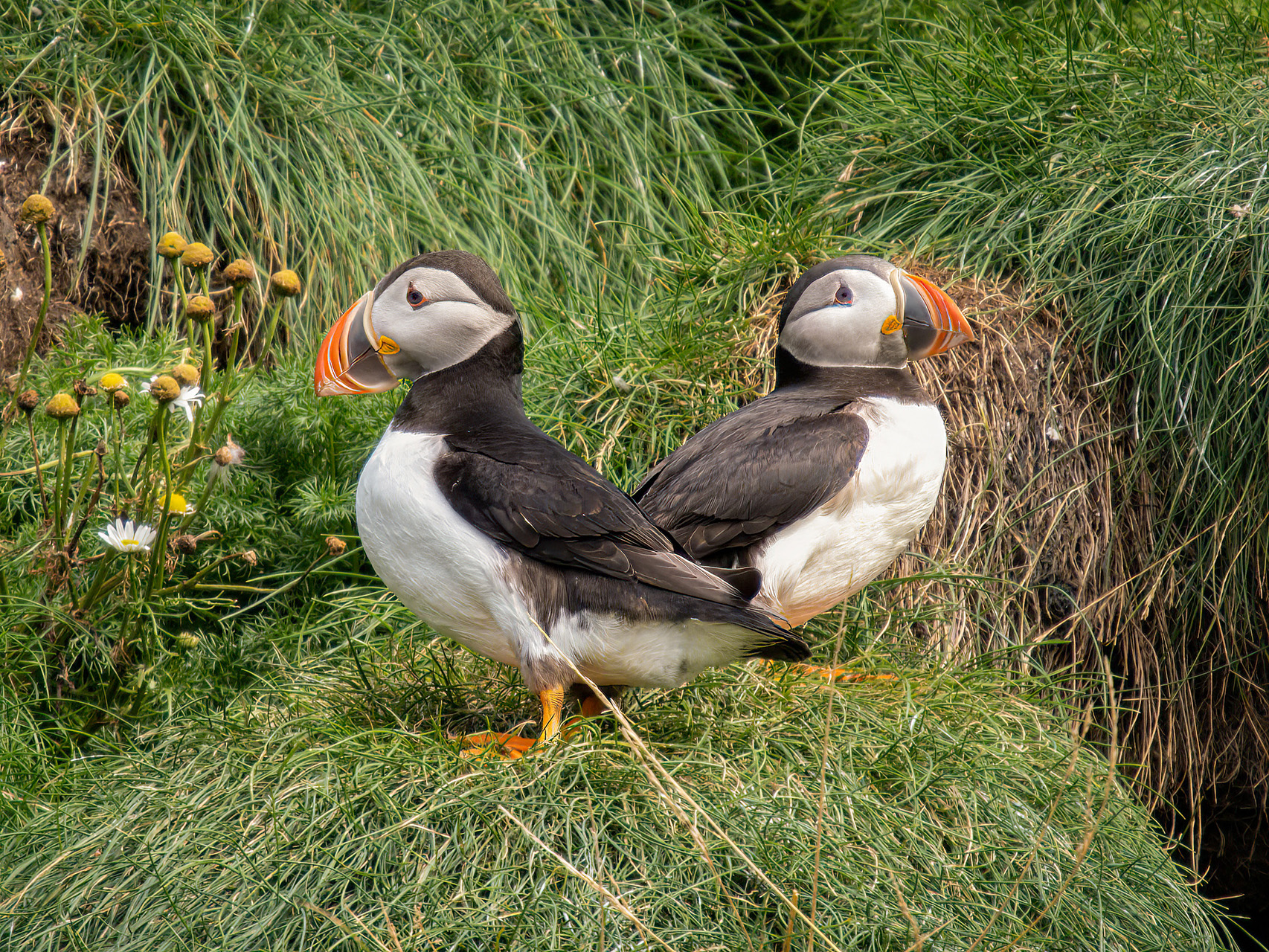
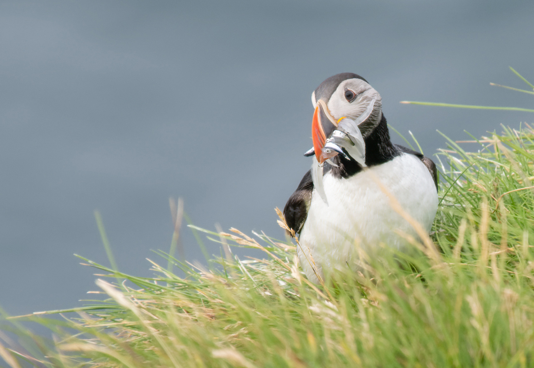
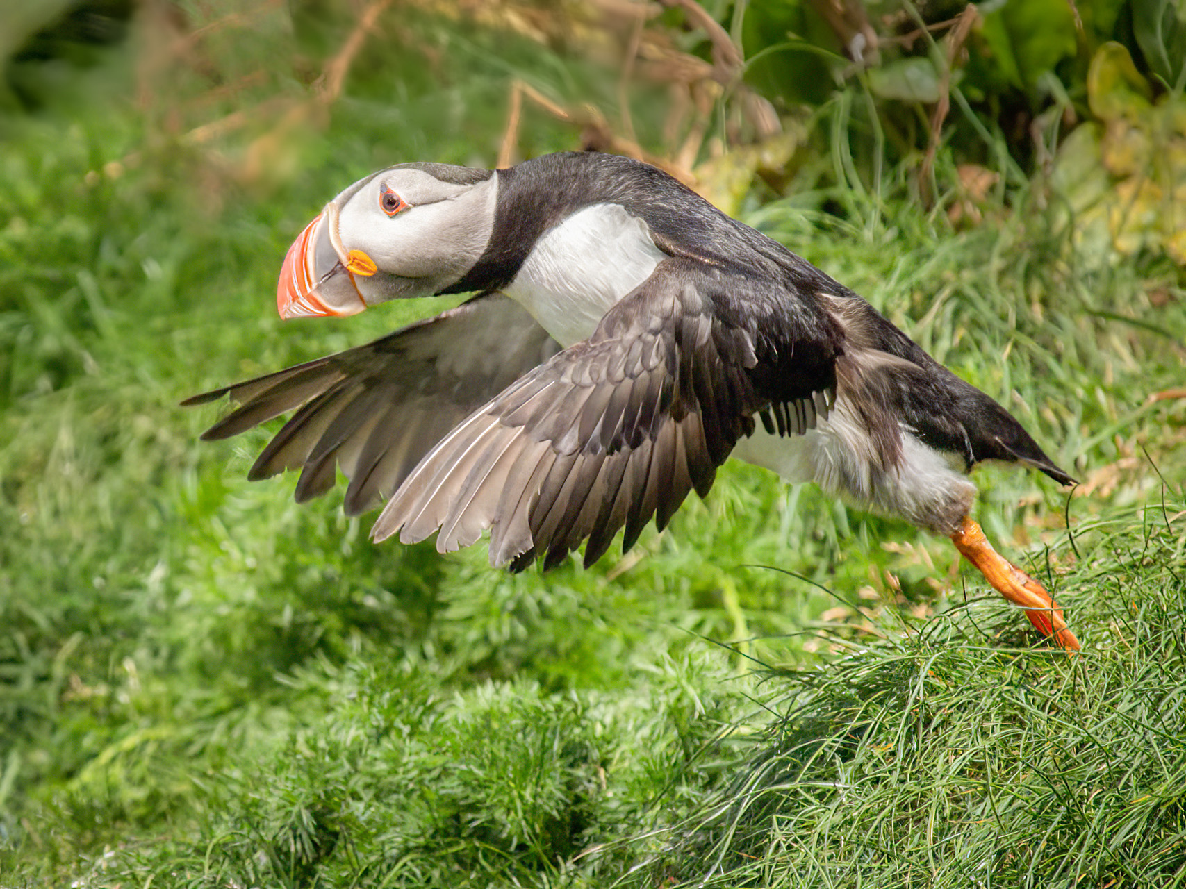
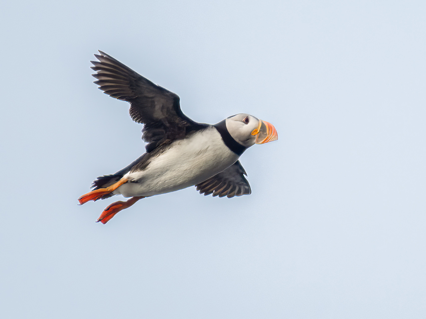
Taking a ferry to the island of Heimaey seemed like a great idea, but our two days there were again accompanied by heavy rain and strong winds. Yet, this is an interesting island: it is not only home to Europe’s largest colony of puffins (see also ‘Fauna&Flora’), but also the site where one of the continent’s youngest volcano was created: in 1973, the town of Vestmannaeyjar had to be completely evacuated and lost about 400 houses to a newly forming volcano that also made the island quite a bit larger. You can see on one image how close the lava got to the town. In fact, the locals saved the harbor, their only meaningful source of income, by spraying enormous amounts of sea water onto the progressing lava so it would not reach the harbor area.
The final area of Iceland I’d like to present here is Thingvellir, a Unesco World Heritage site celebrated as the cradle of Iceland’s parliamentary democracy. Starting in 930, the Vikings met here once a year to dispense justice and pass laws. Iceland’s ultimate independence, in 1944, was also declared here, making the place the country’s most important one in the eyes of most Icelanders. Look for the Iceland flag in the image that marks the exact meeting area.


Fauna&Flora
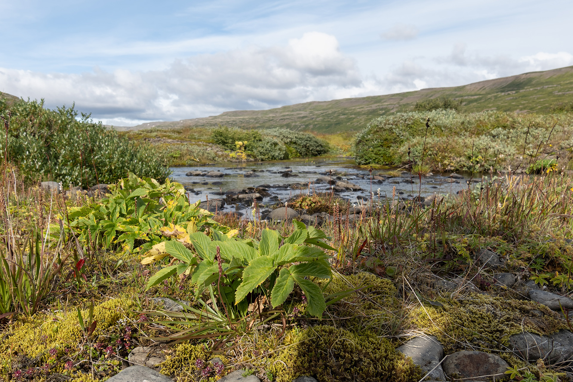
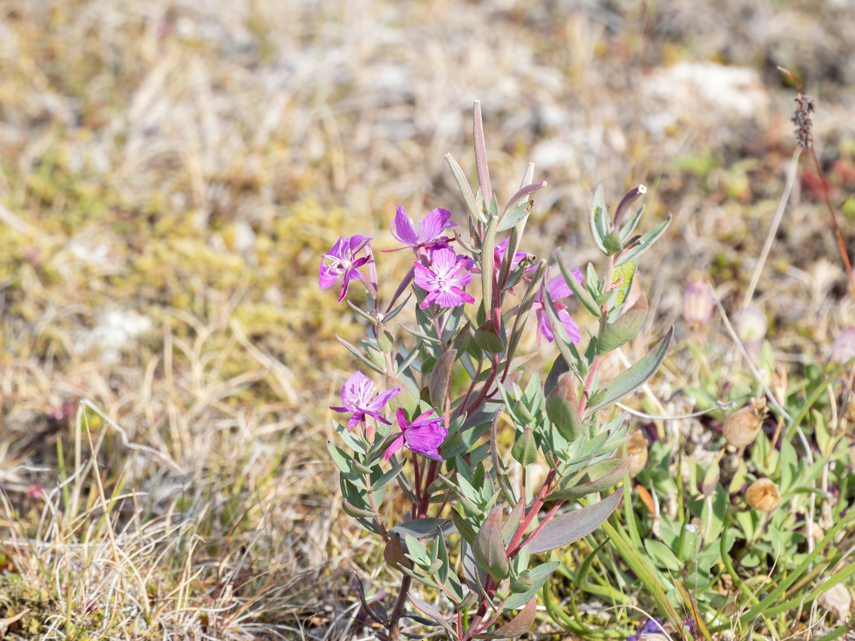
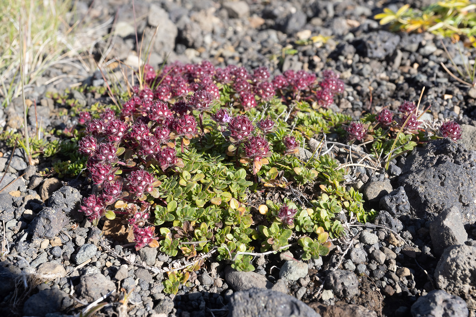
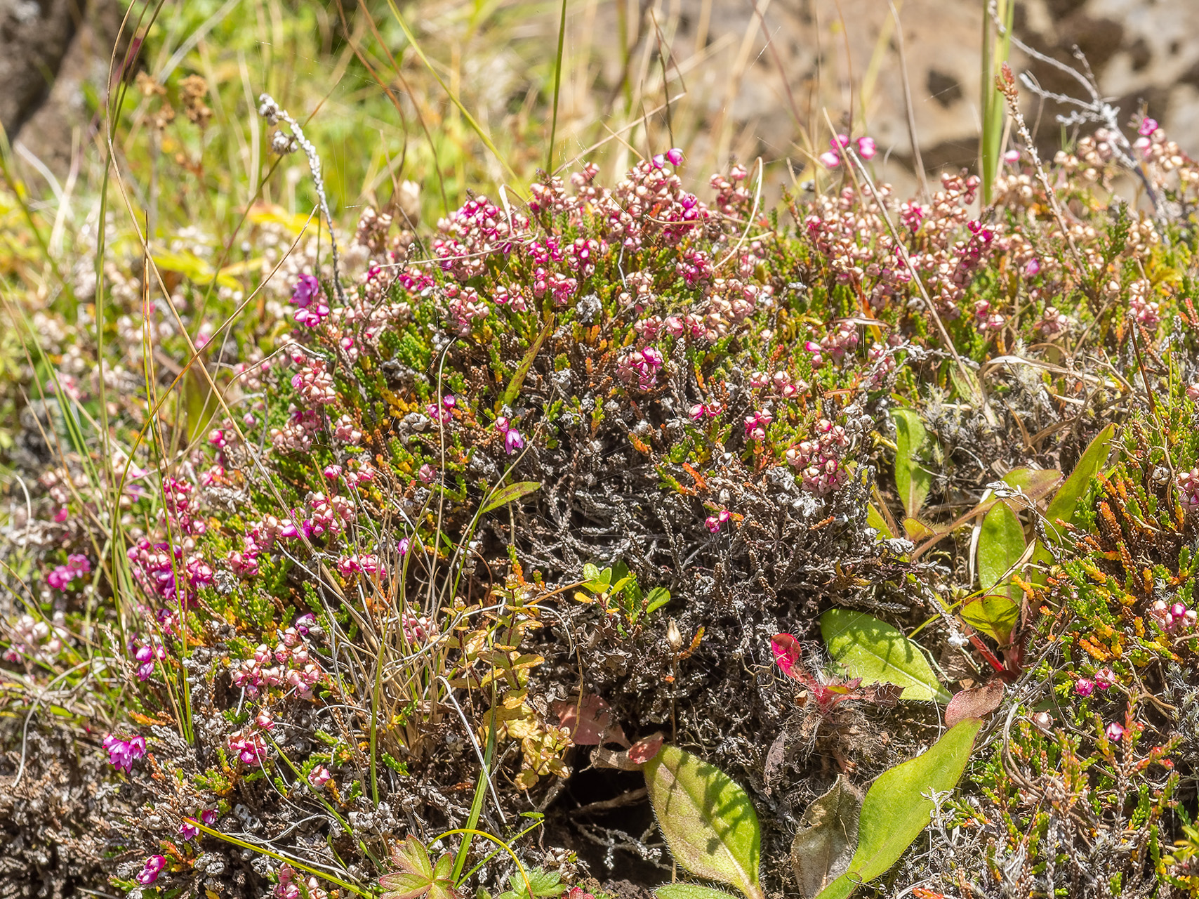
I couldn’t possibly wrap up a travel report without commenting on the plants and wildlife. Iceland’s plant life is admirable, given the austerity of the volcanic landscapes. Mosses dominate some areas, and forests are few and far between, but there is still plenty of plant life to be appreciated.
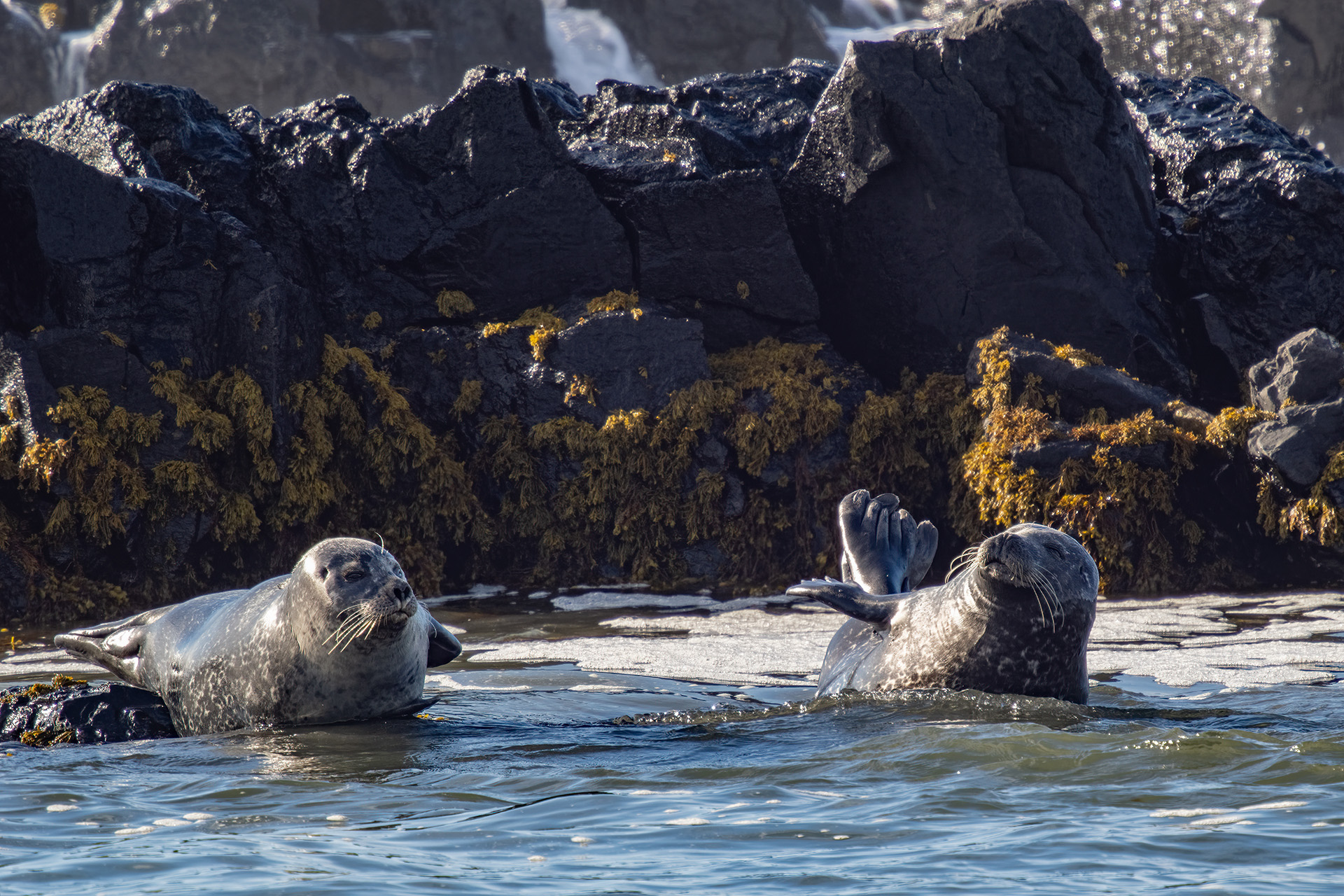
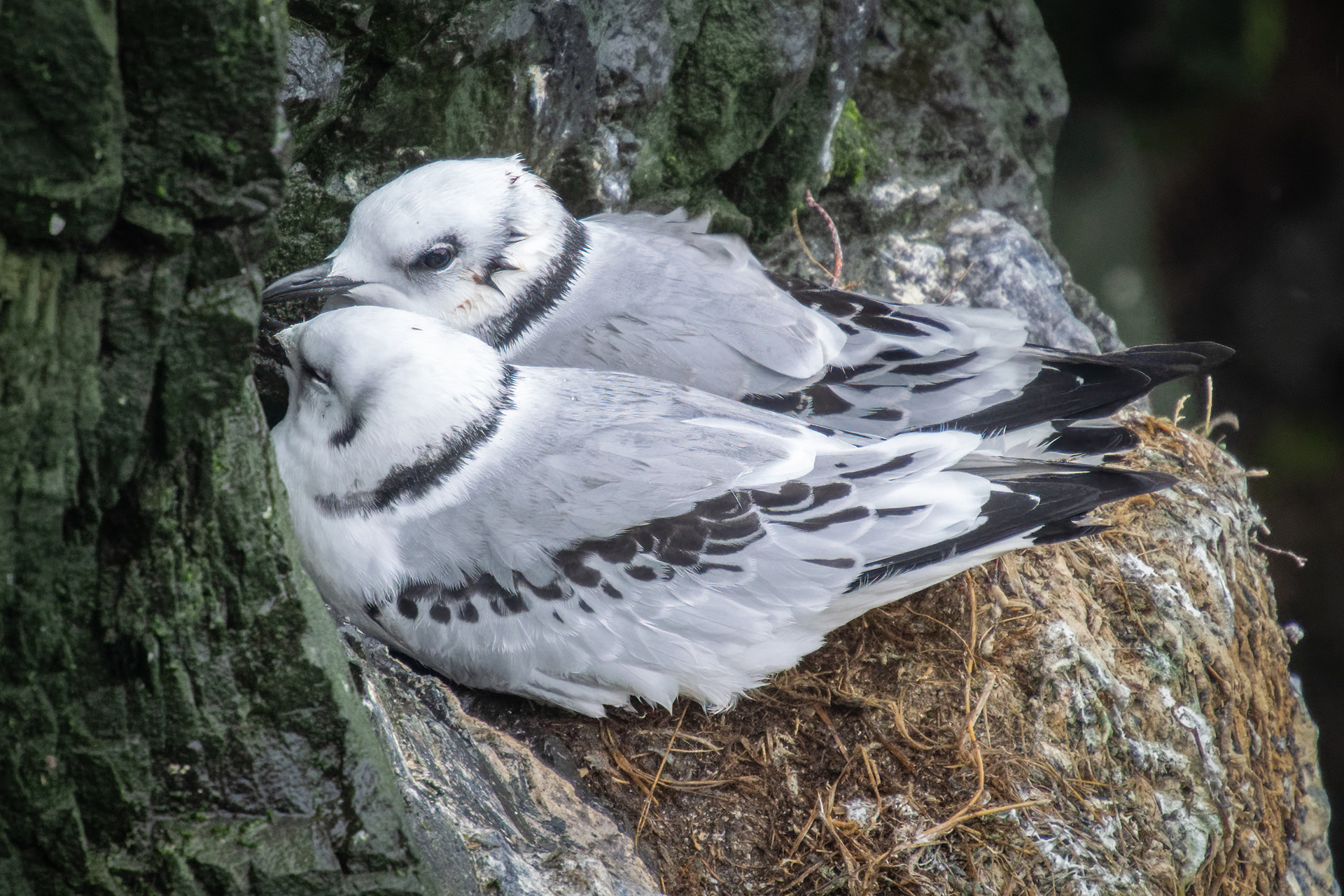
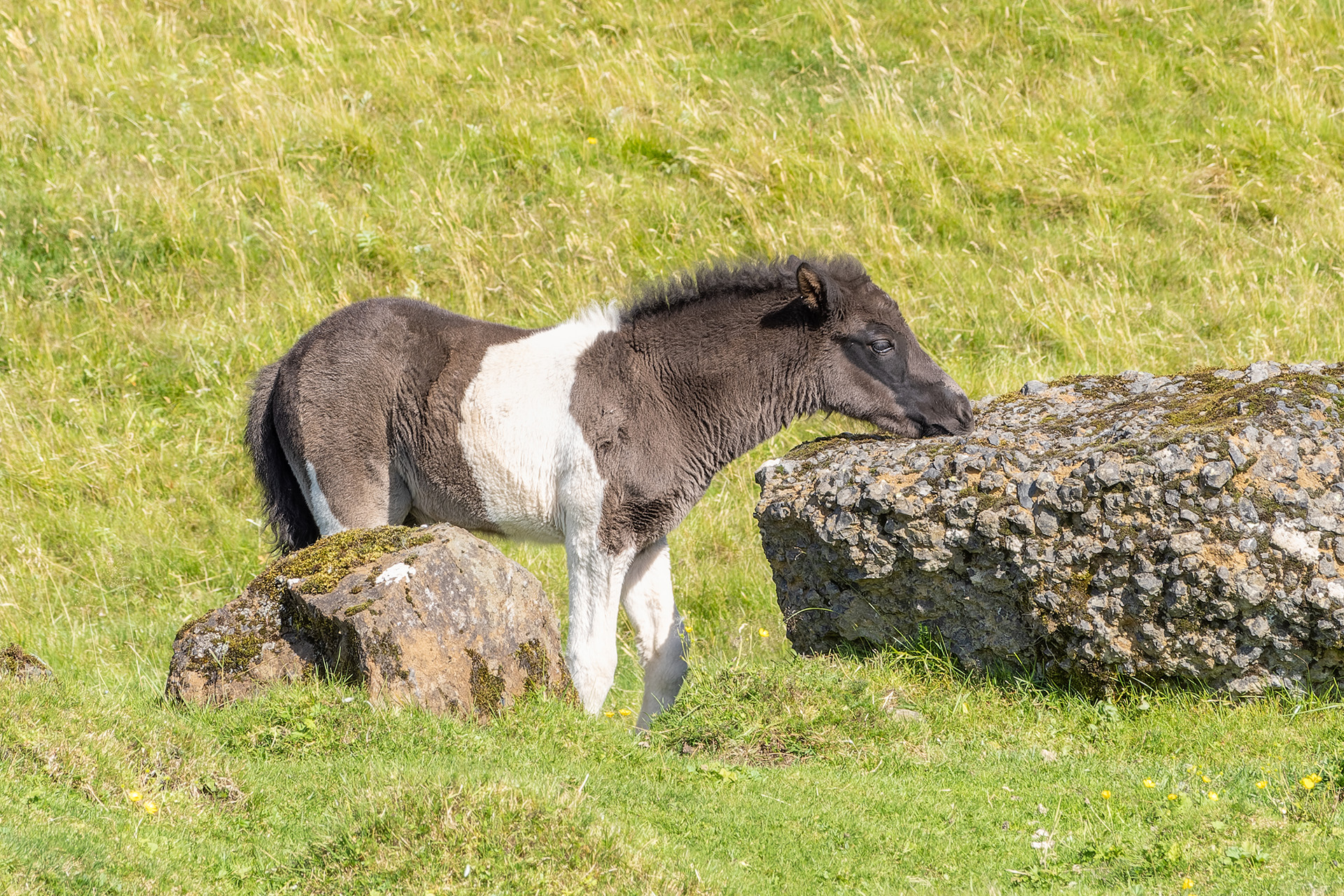
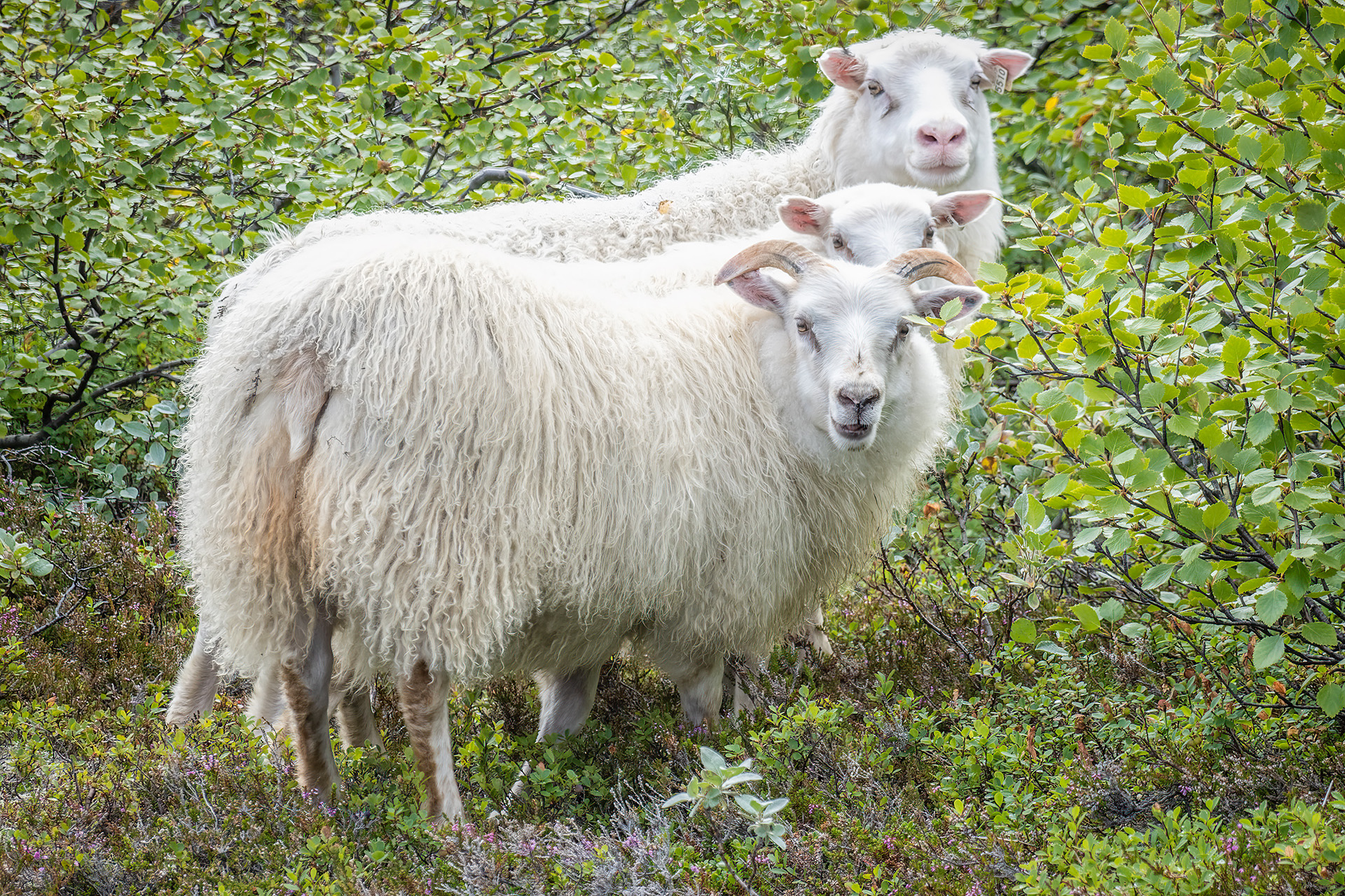
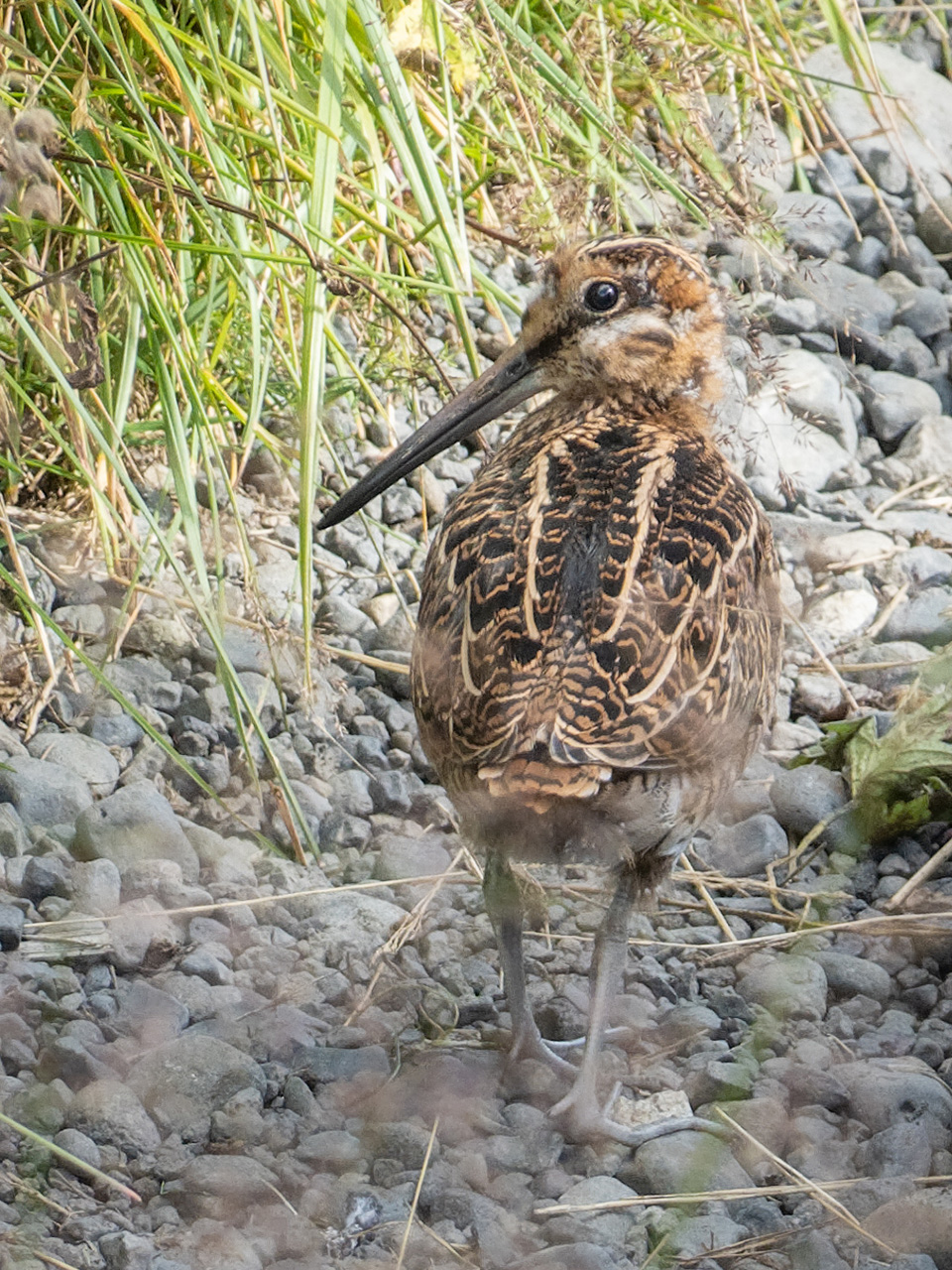
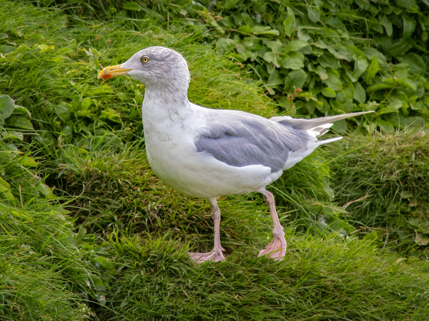
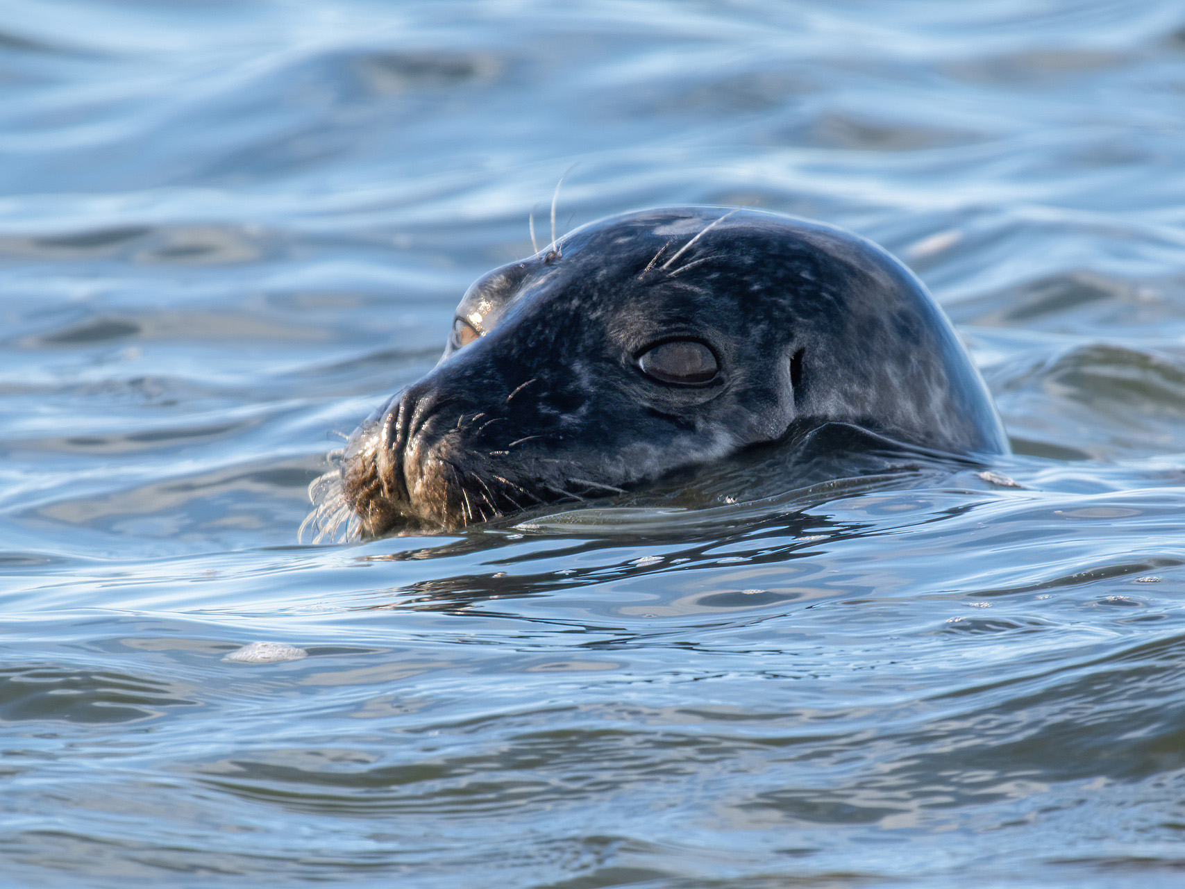
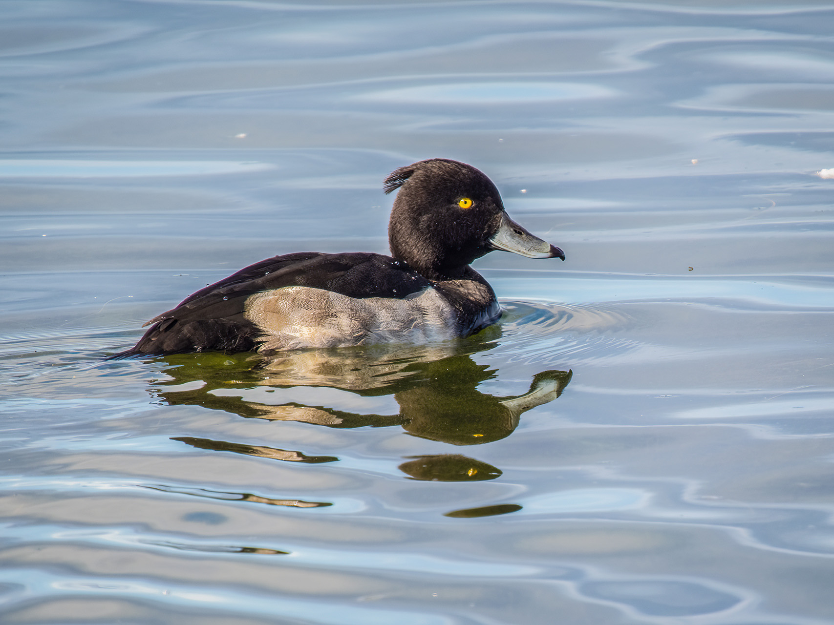
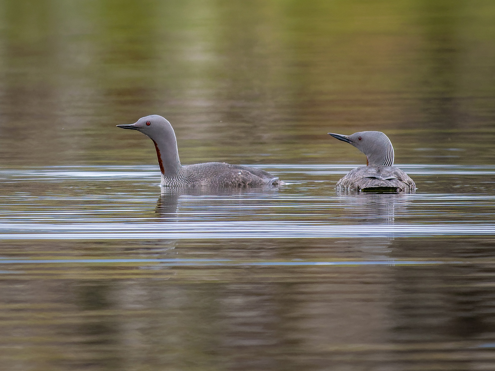
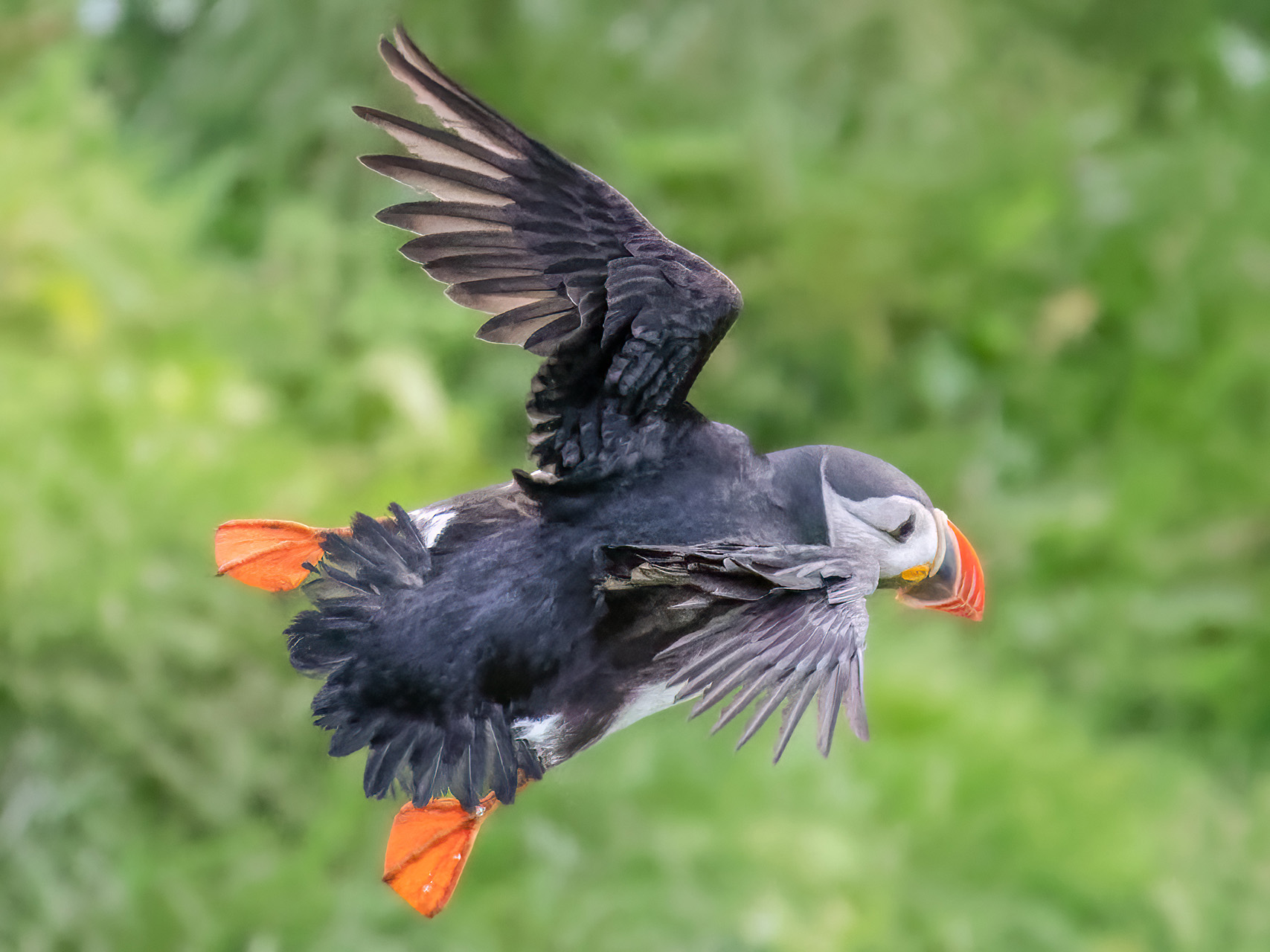
Without a doubt, Iceland’s #1 mammal is the sheep. They are everywhere, fenced-in or free-roaming, high up on the slopes or right on the highways, white, brown, black or anything in-between. This island must be home to far more sheep than humans. Apart from horses and ponies, though, you rarely see other animals except for birds. Unsurprisingly, most of the island’s birds live on the lakes, like the 14 different species of duck found on Myvatn, or near the sea. My favorite bird, the one I was eager to see, however, was nowhere to be found until we had made it more than three-quarters around the island. That is because puffins already leave their nesting areas in most of the country during the first half of August, just before we arrived. Fortunately, they were willing to make an exception at one spot on the southern coast, as well as on Heimaey island. J

Bottom line
Ours was the lousiest summer weather we ever experienced, yet we loved every day of our trip. Iceland is special and impossible to compare with anything else we saw on this planet. It is VERY worth experiencing.